IMAGES TAKEN NEAR TO
Burnsall Close, CARLISLE, CA2 6TL
Introduction
This page details the photographs taken nearby to Burnsall Close, CA2 6TL by members of the Geograph project.
The Geograph project started in 2005 with the aim of publishing, organising and preserving representative images for every square kilometre of Great Britain, Ireland and the Isle of Man.

There are currently over 7.5m images from over14,400 individuals and you can help contribute to the project by visiting https://www.geograph.org.uk
Image Map (Loading...)


Getting Data...Please wait
Leaflet Map data © OpenStreetMap
Images are licensed for reuse under creativecommons.org/licenses/by-sa/2.0
Notes
- Clicking on the map will re-center to the selected point.
- The higher the marker number, the further away the image location is from the centre of the postcode.
Image Listing (30 Images Found)
Images are licensed for reuse under creativecommons.org/licenses/by-sa/2.0
Image
Details
Distance
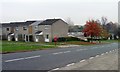
1
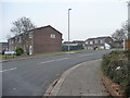
Hebden Avenue, Carlisle
Looking west from the junction with Queensway.
Image: © Christine Johnstone
Taken: 2 Nov 2015
0.04 miles
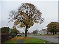
2
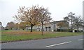
Autumn tree, Whernside, Carlisle
On the east side of Queensway.
Image: © Christine Johnstone
Taken: 2 Nov 2015
0.05 miles
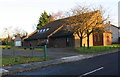
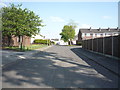
5
Postbox and autumn tree, Whernside, Carlisle
The parallel blocks of houses in Whernside have a footpath at their front doors and a road behind their back gardens.
Image: © Christine Johnstone
Taken: 2 Nov 2015
0.10 miles
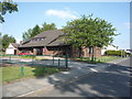
6
Autumn tree, Orton Road, Carlisle
On the north side, opposite the junction with Queensway.
Image: © Christine Johnstone
Taken: 2 Nov 2015
0.10 miles

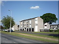
10
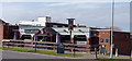
The Reiver, Holmrook Road, Carlisle - March 2017 (1)
Originally "The Border Reiver", this was the last pub opened by the State Management Scheme. Opened in July 1971 and sold to private ownership in May 1973, the original pub sign depicted someone with a more than passing resemblance to Robin Hood (who was neither Scottish nor a Reiver), but this is presumed lost when the pub name was changed.
Still trading. See also: Image] , Image] and Image] .
Photograph is for record only - I have no connection with this business and cannot advise on its products or services.
Image: © The Carlisle Kid
Taken: 8 Mar 2017
0.15 miles