IMAGES TAKEN NEAR TO
Newby West, CARLISLE, CA2 6QY
Introduction
This page details the photographs taken nearby to CA2 6QY by members of the Geograph project.
The Geograph project started in 2005 with the aim of publishing, organising and preserving representative images for every square kilometre of Great Britain, Ireland and the Isle of Man.

There are currently over 7.5m images from over14,400 individuals and you can help contribute to the project by visiting https://www.geograph.org.uk
Image Map
Images are licensed for reuse under creativecommons.org/licenses/by-sa/2.0
Notes
- Clicking on the map will re-center to the selected point.
- The higher the marker number, the further away the image location is from the centre of the postcode.
Image Listing (6 Images Found)
Images are licensed for reuse under creativecommons.org/licenses/by-sa/2.0
Image
Details
Distance
3
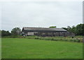
Newby Village electricity substation and Newby West Farm buildings
Image: © Roger Templeman
Taken: 3 Dec 2019
0.03 miles
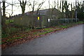
5
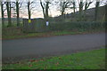
Electricity substation on SE side of road into Newby Village
Ordnance Survey records indicate that there was a benchmark on the wall of the substation in 1972. See www.bench-marks.org.uk/bm103251
Image: © Luke Shaw
Taken: 3 Dec 2019
0.04 miles