IMAGES TAKEN NEAR TO
Grace Lane, Dalston Road, CARLISLE, CA2 6DA
Introduction
This page details the photographs taken nearby to Grace Lane, Dalston Road, CA2 6DA by members of the Geograph project.
The Geograph project started in 2005 with the aim of publishing, organising and preserving representative images for every square kilometre of Great Britain, Ireland and the Isle of Man.

There are currently over 7.5m images from over14,400 individuals and you can help contribute to the project by visiting https://www.geograph.org.uk
Image Map
Images are licensed for reuse under creativecommons.org/licenses/by-sa/2.0
Notes
- Clicking on the map will re-center to the selected point.
- The higher the marker number, the further away the image location is from the centre of the postcode.
Image Listing (7 Images Found)
Images are licensed for reuse under creativecommons.org/licenses/by-sa/2.0
Image
Details
Distance
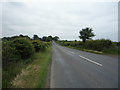
2
Stream in field on SW side of B5299
The stream passes under the road through a culvert Image in the left foreground
Image: © Roger Templeman
Taken: 30 Dec 2021
0.16 miles
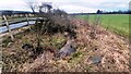
4
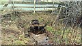
Culvert for stream on SW side of B5299
Ordnance Survey documents indicate that a benchmark levelled at 45.962m above Newlyn Datum was verified on the culvert above the centre of the stream in 1972
Image: © Roger Templeman
Taken: 30 Dec 2021
0.19 miles
7
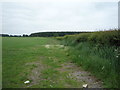
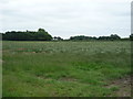
Farmland and hedgerow
Off Dalston Road (B5299).
Image: © JThomas
Taken: 18 Jun 2016
0.25 miles