IMAGES TAKEN NEAR TO
Newcastle Street, CARLISLE, CA2 5UH

Introduction

This page details the photographs taken nearby to Newcastle Street, CA2 5UH by members of the Geograph project.

The Geograph project started in 2005 with the aim of publishing, organising and preserving representative images for every square kilometre of Great Britain, Ireland and the Isle of Man.

There are currently over 7.5m images from over14,400 individuals and you can help contribute to the project by visiting https://www.geograph.org.uk

Image Map


Images are licensed for reuse under creativecommons.org/licenses/by-sa/2.0
Notes
  • Clicking on the map will re-center to the selected point.
  • The higher the marker number, the further away the image location is from the centre of the postcode.

Image Listing (124 Images Found)

Images are licensed for reuse under creativecommons.org/licenses/by-sa/2.0
  • ...
Image
Details
Distance
1
Benchmark on school building, Newcastle Street
Ordnance Survey cut mark benchmark described on the Bench Mark Database at http://www.bench-marks.org.uk/bm30955
Image: © Roger Templeman Taken: 7 Jul 2015
0.02 miles
2
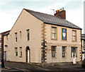
Former school on Newcastle Street up for sale
There is an OS benchmark Image on the stone at the base of the school wall about three feet left of a grey pipe emerging through the wall
Image: © Roger Templeman Taken: 7 Jul 2015
0.02 miles
3
#15 York Street at Kendal Street junction
Ordnance Survey records indicate that a benchmark was levelled at 15.758m above Newlyn Datum in 1972 on the near corner, right hand face, of the house. The house is now covered with pebbledash.
Image: © Roger Templeman Taken: 22 Dec 2020
0.04 miles
4
Morton Street and Dixon's Chimney, Carlisle
Image: © Andrew Smith Taken: 19 Jun 2008
0.05 miles
5
Morton Street and Dixon's Chimney, Carlisle
Image: © Andrew Smith Taken: 19 Jun 2008
0.05 miles
6
Benchmark on #68 Shaddongate
Ordnance Survey cut mark benchmark described on the Bench Mark Database at http://www.bench-marks.org.uk/bm30990
Image: © Roger Templeman Taken: 7 Jul 2015
0.05 miles
7
Junction of Shaddongate and Newcastle Street
There is an OS benchmark Image on the corner of the nearest house, right hand face
Image: © Roger Templeman Taken: 7 Jul 2015
0.05 miles
8
Shaddon Works (Dixon's) Chimney from Shaddongate
The chimney is an Ordnance Survey intersected station trig point, see http://trigpointing.uk/trig/10522 for details
Image: © Roger Templeman Taken: 7 Jul 2015
0.07 miles
9
Dixon's Chimney, Shaddongate
Image: © JThomas Taken: 18 Jun 2016
0.07 miles
10
"Duke of York" pub - December 2016 (1)
Built circa 1823 and known as "Story's Vaults" until 1895, when it was purchased by Carlisle New Brewery and re-named "Duke of York", this pub was acquired by the State in August 1916 and sold to Greenall Whitley on 21 May 1973. Closed in 2000, it has been unused since - its survival seemingly dependent upon continued occupancy of the top floor.
Image: © The Carlisle Kid Taken: 5 Dec 2016
0.07 miles
  • ...