
IMAGES TAKEN NEAR TO
Lake View Avenue, CARLISLE, CA2 4NU
Introduction
This page details the photographs taken nearby to Lake View Avenue, CA2 4NU by members of the Geograph project.
The Geograph project started in 2005 with the aim of publishing, organising and preserving representative images for every square kilometre of Great Britain, Ireland and the Isle of Man.

There are currently over 7.5m images from over14,400 individuals and you can help contribute to the project by visiting https://www.geograph.org.uk
Image Map
Images are licensed for reuse under creativecommons.org/licenses/by-sa/2.0
Notes
- Clicking on the map will re-center to the selected point.
- The higher the marker number, the further away the image location is from the centre of the postcode.
Image Listing (25 Images Found)
Images are licensed for reuse under creativecommons.org/licenses/by-sa/2.0
Image
Details
Distance
1
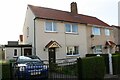
Nos. 26 & 24 Brisco Road
Ordnance Survey documents indicate that a benchmark levelled at 36.235m above Newlyn Datum was verified in 1972 on the now pebbledashed left hand house at its front left hand corner. See www.bench-marks.org.uk/bm103215
Image: © Luke Shaw
Taken: 24 Aug 2019
0.07 miles
2
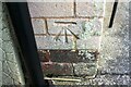
Benchmark on No. 50 Brisco Road
Ordnance Survey cut mark benchmark described on the Bench Mark Database at www.bench-marks.org.uk/bm103216
Image: © Luke Shaw
Taken: 24 Aug 2019
0.09 miles
3
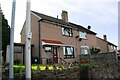
Nos. 50 & 48 Brisco Road
There is an Ordnance Survey benchmark Image on the side of the left hand house at its front corner, right of a wheelie bin
Image: © Luke Shaw
Taken: 24 Aug 2019
0.09 miles
4
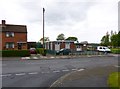
Carlisle, St John Ambulance
On Scalegate Road. http://www.sja.org.uk/sja/about-us.aspx
Image: © Mike Faherty
Taken: 15 May 2012
0.11 miles
5
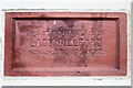
Stone laid by Lady Gillford at Upperby Institute
Dated November 8th 1922. Amongst other plaques laid by local dignitaries, located on the front of the building shown here Image .
Lady Gillford lived at Petteril Bank Image .
Image: © Rose and Trev Clough
Taken: 25 Aug 2014
0.13 miles
6
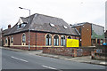
Upperby Men's Institute
A social club in Lamb Street.
Opened on December 26th 1922 by Alderman J.W. Nicholson J.P. - see Image .
Image: © Rose and Trev Clough
Taken: 25 Aug 2014
0.13 miles
7
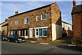
Flats above shops on Lamb Street
Hairdressers and card shop at #29
Image: © Roger Templeman
Taken: 24 Aug 2019
0.13 miles
8
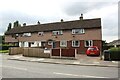
Row of houses on SW side of Scalegate Road
There is an Ordnance Survey benchmark Image on the side of the right hand house at its front corner
Image: © Luke Shaw
Taken: 1 Sep 2020
0.13 miles
9
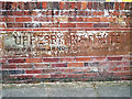
Commemorative stone, Upperby Institute
On the wall of the car park - for location see Image .
Image: © Rose and Trev Clough
Taken: 25 Aug 2014
0.13 miles
10
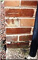
Benchmark on No. 230 Scalegate Road
Ordnance Survey cut mark benchmark described on the Bench Mark Database at www.bench-marks.org.uk/bm103413
Image: © Luke Shaw
Taken: 1 Sep 2020
0.14 miles