IMAGES TAKEN NEAR TO
Ennerdale, CLEATOR, CA23 3AL
Introduction
This page details the photographs taken nearby to CA23 3AL by members of the Geograph project.
The Geograph project started in 2005 with the aim of publishing, organising and preserving representative images for every square kilometre of Great Britain, Ireland and the Isle of Man.

There are currently over 7.5m images from over14,400 individuals and you can help contribute to the project by visiting https://www.geograph.org.uk
Image Map
Images are licensed for reuse under creativecommons.org/licenses/by-sa/2.0
Notes
- Clicking on the map will re-center to the selected point.
- The higher the marker number, the further away the image location is from the centre of the postcode.
Image Listing (4 Images Found)
Images are licensed for reuse under creativecommons.org/licenses/by-sa/2.0
Image
Details
Distance
1
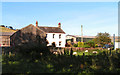
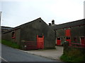
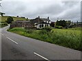
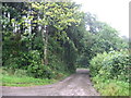
Farmhouse, Ennerdale
This farm is at a bend in the road which some of my colleagues refer to as 'mad-dog corner' because of the way the sheepdogs chase passing vehicles.
Image: © Nigel Monckton
Taken: 2 Sep 2005
0.06 miles