IMAGES TAKEN NEAR TO
The Fairways, SEASCALE, CA20 1RD
Introduction
This page details the photographs taken nearby to The Fairways, CA20 1RD by members of the Geograph project.
The Geograph project started in 2005 with the aim of publishing, organising and preserving representative images for every square kilometre of Great Britain, Ireland and the Isle of Man.

There are currently over 7.5m images from over14,400 individuals and you can help contribute to the project by visiting https://www.geograph.org.uk
Image Map (54 Images)


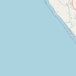
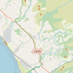

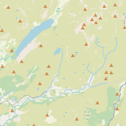

Leaflet Map data © OpenStreetMap
Images are licensed for reuse under creativecommons.org/licenses/by-sa/2.0
Notes
- Clicking on the map will re-center to the selected point.
- The higher the marker number, the further away the image location is from the centre of the postcode.
Image Listing (54 Images Found)
Images are licensed for reuse under creativecommons.org/licenses/by-sa/2.0
Image
Details
Distance
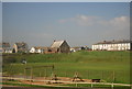
2
Seascale Methodist Church - May 2018
Dating from circa 1886, information on Church events may be found: http://www.whitehaven-methodist-circuit.org.uk/seascale.html
Image: © The Carlisle Kid
Taken: 14 May 2018
0.08 miles
3
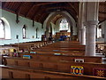
St Cuthberts Church, Seascale, Interior
Image: © Alexander P Kapp
Taken: 13 Apr 2011
0.08 miles
4
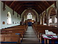
St Cuthberts Church, Seascale, Interior
Image: © Alexander P Kapp
Taken: 13 Apr 2011
0.08 miles
5
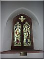
St Cuthberts Church, Seascale, Stained glass window
Image: © Alexander P Kapp
Taken: 13 Apr 2011
0.08 miles
6
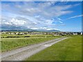
Track beside Seascale Golf Course
The track runs along the edge of Seascale Golf Course from the village to How Farm and it is a public footpath.
The southernmost of the Lake District fells are in the background with the rounded bulk of Black Combe prominent.
Image: © Adrian Taylor
Taken: 31 May 2022
0.08 miles
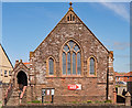
8
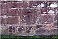
Benchmark on St Cuthbert's Church
Ordnance Survey cut mark benchmark levelled at 19.379m above Newlyn Datum in 1965
Image: © Luke Shaw
Taken: 29 Oct 2018
0.08 miles
9
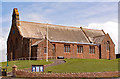
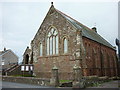
St Cuthbert's Church, Seascale - May 2018
Grade II listed Church dating from 1879-1890 - details of the listing may be found: https://www.britishlistedbuildings.co.uk/101356150-church-of-st-cuthbert-seascale#.WvwAM0xFwuU
The Church is open daily and donations are welcome. There is no Guide Book. All queries should be directed through the Church web site at: http://www.seascalestcuthberts.org.uk/
Image: © The Carlisle Kid
Taken: 12 May 2018
0.08 miles
10
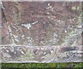
Ordnance Survey Cut Mark
This OS cut mark can be found on the north face of St Cuthbert's Church. It marks a point 19.379m above mean sea level.
Image: © Adrian Dust
Taken: 7 Nov 2016
0.08 miles