IMAGES TAKEN NEAR TO
Briarcote, KIRKBY STEPHEN, CA17 4RD

Introduction

This page details the photographs taken nearby to Briarcote, CA17 4RD by members of the Geograph project.

The Geograph project started in 2005 with the aim of publishing, organising and preserving representative images for every square kilometre of Great Britain, Ireland and the Isle of Man.

There are currently over 7.5m images from over14,400 individuals and you can help contribute to the project by visiting https://www.geograph.org.uk

Image Map


Images are licensed for reuse under creativecommons.org/licenses/by-sa/2.0
Notes
  • Clicking on the map will re-center to the selected point.
  • The higher the marker number, the further away the image location is from the centre of the postcode.

Image Listing (354 Images Found)

Images are licensed for reuse under creativecommons.org/licenses/by-sa/2.0
  • ...
Image
Details
Distance
1
Local Links, Vicarage Drive
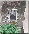
There is an Ordnance Survey benchmark Image on the front of the building on the left hand side of the entrance
Image: © Roger Templeman Taken: 5 Sep 2017
0.03 miles
2
Tomb of Thomas, 1st Lord Wharton in Kirkby Stephen Church
'of Wharton Hall in this parish; died 1568 On the right: Eleanor Stapleton daughter of Sir Brian Stapleton of Wighill On the left: Annie daughter of George Earl of Shrewsbury' The ladies are the two wives of Lord Thomas.
Image: © Karl and Ali Taken: 18 Aug 2013
0.05 miles
3
Kirkby Stephen parish church: east window
A stained glass window comprising three separate lancets.
Image: © Stephen Craven Taken: 25 Jun 2009
0.05 miles
4
Sacred to the memory of ...... no longer, Kirkby Stephen
These old gravestones have been lined up alongside the wall of the churchyard.
Image: © Karl and Ali Taken: 18 Aug 2013
0.05 miles
5
Kirkby Stephen Parish Church, East Window
Image: © David Dixon Taken: 24 Jun 2011
0.05 miles
6
Inside Kirkby Stephen Parish Church
Image: © David Dixon Taken: 24 Jun 2011
0.05 miles
7
Ordnance Survey Flush Bracket G2360
This bracket can be found on the wall of the former Grammar School. For more detail see : http://www.bench-marks.org.uk/bm14454
Image: © Peter Wood Taken: 4 Jun 2012
0.05 miles
8
Benchmark at entrance to Local Links offices
Ordnance Survey flush bracket (serial identifier G2360) benchmark described on the Bench Mark Database at www.bench-marks.org.uk/bm14454
Image: © Roger Templeman Taken: 5 Sep 2017
0.05 miles
9
Ordnance Survey Flush Bracket (G2360)
This OS Flush Bracket can be found on the west face of the school. It marks a point 175.019m above mean sea level.
Image: © Adrian Dust Taken: 28 Oct 2023
0.05 miles
10
The Old Bakery
Image: © David Brown Taken: 20 Nov 2013
0.06 miles
  • ...