
IMAGES TAKEN NEAR TO
Scattergate Crescent, APPLEBY-IN-WESTMORLAND, CA16 6SR
Introduction
This page details the photographs taken nearby to Scattergate Crescent, CA16 6SR by members of the Geograph project.
The Geograph project started in 2005 with the aim of publishing, organising and preserving representative images for every square kilometre of Great Britain, Ireland and the Isle of Man.

There are currently over 7.5m images from over14,400 individuals and you can help contribute to the project by visiting https://www.geograph.org.uk
Image Map
Images are licensed for reuse under creativecommons.org/licenses/by-sa/2.0
Notes
- Clicking on the map will re-center to the selected point.
- The higher the marker number, the further away the image location is from the centre of the postcode.
Image Listing (62 Images Found)
Images are licensed for reuse under creativecommons.org/licenses/by-sa/2.0
Image
Details
Distance
1
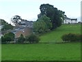
Houses in Scattergate Crescent, Appleby
With 'New House' on Parkin Hill beyond.
Image: © Christine Johnstone
Taken: 13 Oct 2016
0.03 miles
2
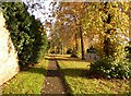
Verge, Scattergate, Appleby
This is the road to Orton, behind the castle. Part of the wall around the castle grounds is on the left.
Image: © Humphrey Bolton
Taken: 3 Nov 2006
0.06 miles
3
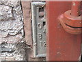
Ordnance Survey Flush Bracket 1250
This bracket can be found on a farm barn wall at Parkin Hill.
For more detail see : http://www.bench-marks.org.uk/bm2403
Image: © Peter Wood
Taken: 4 Jun 2012
0.08 miles
4
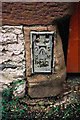
Benchmark at Castle Bank Farm
Ordnance Survey flush bracket (serial number 1250) benchmark described on the Bench Mark Database at http://www.bench-marks.org.uk/bm2403
Image: © Roger Templeman
Taken: 12 Jul 2007
0.08 miles
5
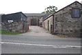
Castle Bank Farm beside B6260
There is an OS flush bracket benchmark Image at the left hand side of the large wooden gates at the far end of the access road
Image: © Roger Templeman
Taken: 22 Jul 2015
0.08 miles
6
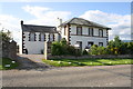
'New House', Parkin Hill beside B6260
There is an OS benchmark Image on the right hand gatepost at the house entrance
Image: © Roger Templeman
Taken: 22 Jul 2015
0.09 miles
7
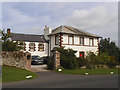
New House, Parkin Hill, Appleby
One of two grade II listed houses on this road, this one dates from the early-mid 19th century (list entry 1145556).
Image: © Stephen Craven
Taken: 3 Aug 2019
0.09 miles
8
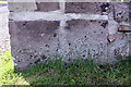
Benchmark on gatepost of 'New House', Parkin Hill
Ordnance Survey cut mark benchmark described on the Bench Mark Database at http://www.bench-marks.org.uk/bm28582
Image: © Roger Templeman
Taken: 22 Jul 2015
0.09 miles
9
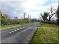
B6260, Parkin Hill
National Cycle Route 68 towards Appleby.
Image: © JThomas
Taken: 30 Apr 2021
0.11 miles
10
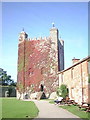
Appleby Castle
Caesar's Tower at Appleby Castle built it is thought on the site of a Roman tower.
Image: © Carl Bendelow
Taken: 17 Sep 1998
0.12 miles