
IMAGES TAKEN NEAR TO
Glebe Road, APPLEBY-IN-WESTMORLAND, CA16 6RT
Introduction
This page details the photographs taken nearby to Glebe Road, CA16 6RT by members of the Geograph project.
The Geograph project started in 2005 with the aim of publishing, organising and preserving representative images for every square kilometre of Great Britain, Ireland and the Isle of Man.

There are currently over 7.5m images from over14,400 individuals and you can help contribute to the project by visiting https://www.geograph.org.uk
Image Map
Images are licensed for reuse under creativecommons.org/licenses/by-sa/2.0
Notes
- Clicking on the map will re-center to the selected point.
- The higher the marker number, the further away the image location is from the centre of the postcode.
Image Listing (48 Images Found)
Images are licensed for reuse under creativecommons.org/licenses/by-sa/2.0
Image
Details
Distance
1
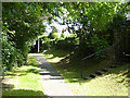
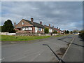
Footpath above the River Eden
Urban footpath in Appleby-in-Westmorland which runs high above the River Eden. To the right, the back of the houses on Glebe Road.
Image: © Oliver Dixon
Taken: 15 Jul 2015
0.05 miles
2
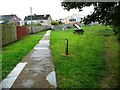
Choice of footpaths, The Banks, Appleby
Left [south-west] for Margaret's Way, right [west] for Colby Laithes.
Image: © Christine Johnstone
Taken: 13 Oct 2016
0.07 miles
3
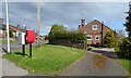
Margaret's Way, Appleby
Showing position of Postbox No. CA16 331.
See Image] for postbox.
Image: © JThomas
Taken: 30 Apr 2021
0.08 miles
4
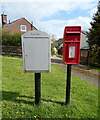
Elizabeth II postbox on Colby Lane, Appleby
Postbox No. CA16 331.
See Image] for context.
Image: © JThomas
Taken: 30 Apr 2021
0.08 miles
6
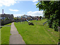
Children's play area
At the back of Margaret's Way on the western edge of Appleby-in-Westmorland.
Image: © Oliver Dixon
Taken: 15 Jul 2015
0.10 miles
7
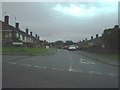
Margarets Way, Appleby-in-Westmorland
Image: © Alexander P Kapp
Taken: 30 Jun 2006
0.11 miles
8

Row of houses on Colby Lane
There is a benchmark Image on the left hand jamb of the middle house which replaces an original Ordnance Survey benchmark Image
Image: © Roger Templeman
Taken: 13 May 2015
0.12 miles
9
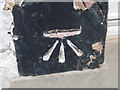
Ordnance Survey Cut Mark
This mark can be found on a house wall in Colby Lane.
For more detail see : http://www.bench-marks.org.uk/bm24352
Image: © Peter Wood
Taken: 4 Jun 2012
0.12 miles
10
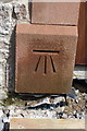
'Benchmark' on #6 Colby Lane
This replica mark has been cut on the door jamb following the renovation of the house during which the Ordnance Survey cut mark benchmark described on the Bench Mark Database at http://www.bench-marks.org.uk/bm24352 was destroyed
Image: © Roger Templeman
Taken: 13 May 2015
0.12 miles