
IMAGES TAKEN NEAR TO
Great Asby, APPLEBY-IN-WESTMORLAND, CA16 6HD
Introduction
This page details the photographs taken nearby to CA16 6HD by members of the Geograph project.
The Geograph project started in 2005 with the aim of publishing, organising and preserving representative images for every square kilometre of Great Britain, Ireland and the Isle of Man.

There are currently over 7.5m images from over14,400 individuals and you can help contribute to the project by visiting https://www.geograph.org.uk
Image Map
Images are licensed for reuse under creativecommons.org/licenses/by-sa/2.0
Notes
- Clicking on the map will re-center to the selected point.
- The higher the marker number, the further away the image location is from the centre of the postcode.
Image Listing (57 Images Found)
Images are licensed for reuse under creativecommons.org/licenses/by-sa/2.0
Image
Details
Distance
1
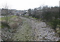
Asby Beck
Seen here in normal water levels. The water is flowing underground, rising at a spring near the Primary School.
Image: © Bob Jenkins
Taken: 25 Mar 2006
0.01 miles
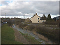
3
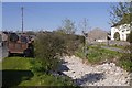
Asby Beck
The burn is flowing beneath its bed, through a cave system.
Image: © Richard Webb
Taken: 9 May 2016
0.02 miles
5

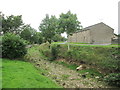
Dry river bed, Great Asby
This is Asby Beck, which looks as if its bed is on limestone and flow in dry weather is underground.
Image: © Humphrey Bolton
Taken: 16 May 2025
0.02 miles
6
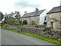
Houses at Great Asby
On the west side of the Beck.
Image: © Oliver Dixon
Taken: 8 Aug 2019
0.02 miles
8
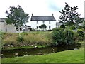
Asby Beck
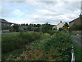
Asby Beck effectively divides the village of Great Asby in two with only one road bridge and three footbridges linking the two halves.
Image: © Oliver Dixon
Taken: 8 Aug 2019
0.03 miles
9
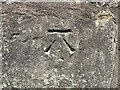
Benchmark, Smithy Cottage
Detail of the Ordnance Survey cut benchmark on the west angle, southwest face of Smithy Cottage, Great Asby. The benchmark marks a height of 181.2585m above mean sea level (Ordnance Datum Newlyn) last verified in 1971 (location photograph Image).
Image: © Adrian Taylor
Taken: 23 Jul 2024
0.03 miles
10
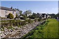
Asby Beck
A limestone feature: the water is mostly flowing through a cave system. The caves flood quickly according to the caving guidebooks, so water is probably seen flowing here often.
Image: © Richard Webb
Taken: 9 May 2016
0.03 miles