IMAGES TAKEN NEAR TO
Brockham Wood, APPLEBY-IN-WESTMORLAND, CA16 6ED
Introduction
This page details the photographs taken nearby to Brockham Wood, CA16 6ED by members of the Geograph project.
The Geograph project started in 2005 with the aim of publishing, organising and preserving representative images for every square kilometre of Great Britain, Ireland and the Isle of Man.

There are currently over 7.5m images from over14,400 individuals and you can help contribute to the project by visiting https://www.geograph.org.uk
Image Map
Images are licensed for reuse under creativecommons.org/licenses/by-sa/2.0
Notes
- Clicking on the map will re-center to the selected point.
- The higher the marker number, the further away the image location is from the centre of the postcode.
Image Listing (11 Images Found)
Images are licensed for reuse under creativecommons.org/licenses/by-sa/2.0
Image
Details
Distance
1
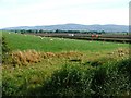
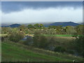
Farmland, Near Bolton
Taken looking north from the bend on the minor road to Bolton. The lorries are heading west on the A66. In the distance can be seen the flat summit of Cross Fell.
Image: © Mick Garratt
Taken: 3 Sep 2005
0.14 miles
2
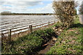
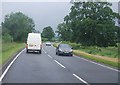
Ditch beside minor road to Westley Bank Cottages
There used to be an Ordnance Survey benchmark on a culvert here which has been rebuilt. Some interesting cultivation practice in the field on the left.
Image: © Roger Templeman
Taken: 7 May 2015
0.14 miles
6
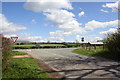
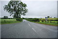
Junction of road from Bolton with A66
In the 1850s Bolton Lane End Toll House was situated on the far side of the main road right of the junction. See http://www.bench-marks.org.uk/bm50127 for more information
Image: © Roger Templeman
Taken: 7 May 2015
0.22 miles
7
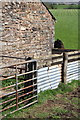
Stable with benchmark beside A66
The Ordnance Survey cut mark benchmark on the quoin beside the horse's neck is described on the Bench Mark Database at http://www.bench-marks.org.uk/bm66545
Image: © Roger Templeman
Taken: 7 May 2015
0.22 miles
8
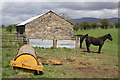
Stable at Meadow Ing Farm
There is an OS benchmark Image on a quoin on the right hand corner of the stable
Image: © Roger Templeman
Taken: 7 May 2015
0.22 miles
9
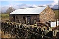
Tollhouse by the A66, Bolton End, Crackenthorpe
Tollhouse by the A66, in the parish of Crackenthorpe (Eden District), Bolton End.
To be surveyed
Milestone Society National ID: CB.CRA
Image: © Milestone Society
Taken: Unknown
0.22 miles