
IMAGES TAKEN NEAR TO
Knock, APPLEBY-IN-WESTMORLAND, CA16 6DR
Introduction
This page details the photographs taken nearby to CA16 6DR by members of the Geograph project.
The Geograph project started in 2005 with the aim of publishing, organising and preserving representative images for every square kilometre of Great Britain, Ireland and the Isle of Man.

There are currently over 7.5m images from over14,400 individuals and you can help contribute to the project by visiting https://www.geograph.org.uk
Image Map
Images are licensed for reuse under creativecommons.org/licenses/by-sa/2.0
Notes
- Clicking on the map will re-center to the selected point.
- The higher the marker number, the further away the image location is from the centre of the postcode.
Image Listing (6 Images Found)
Images are licensed for reuse under creativecommons.org/licenses/by-sa/2.0
Image
Details
Distance
1
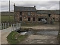
Milburn Grange Ford
This ford on the Milburn Beck is found at Milburn Grange. A new bridge has been constructed since this picture by Oliver Dixon was taken back in 2006: http://www.geograph.org.uk/photo/220299
A video of the ford can be seen at:
https://youtu.be/8RpRKQRYMU8
Image: © John Walton
Taken: 28 Mar 2018
0.03 miles
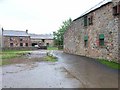
3
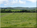
Field with cattle near Knock village
The North Pennine escarpment dominates the skyline with the radome on Great Dun Fell Image in the centre of the view.
Image: © Oliver Dixon
Taken: 15 Jul 2015
0.17 miles
5
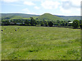
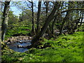
Field near Knock village
Knock Pike Image is a prominent feature with the North Pennine escarpment beyond.
Image: © Oliver Dixon
Taken: 15 Jul 2015
0.18 miles
6
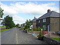
Silverband Villas
Row of houses out in the country near Knock village.
Image: © Oliver Dixon
Taken: 15 Jul 2015
0.24 miles