
IMAGES TAKEN NEAR TO
Dufton, APPLEBY-IN-WESTMORLAND, CA16 6DE
Introduction
This page details the photographs taken nearby to CA16 6DE by members of the Geograph project.
The Geograph project started in 2005 with the aim of publishing, organising and preserving representative images for every square kilometre of Great Britain, Ireland and the Isle of Man.

There are currently over 7.5m images from over14,400 individuals and you can help contribute to the project by visiting https://www.geograph.org.uk
Image Map
Images are licensed for reuse under creativecommons.org/licenses/by-sa/2.0
Notes
- Clicking on the map will re-center to the selected point.
- The higher the marker number, the further away the image location is from the centre of the postcode.
Image Listing (130 Images Found)
Images are licensed for reuse under creativecommons.org/licenses/by-sa/2.0
Image
Details
Distance
2
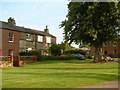
In Dufton
Dufton is typical of many villages in the Eden Valley with old houses spread around a large green. Wainwright in his 'Pennine Way Companion' describes it as "a typically charming Westmorland rural scene." Dufton is indeed on the Pennine Way and makes a useful stop after the long trek from Teesdale.
Image: © Marathon
Taken: 28 Aug 2018
0.01 miles
3
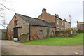
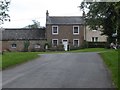
Houses and outbuilding
There is an OS benchmark Image on the near corner, right hand face, of the outbuilding, beside a black downpipe.
Image: © Roger Templeman
Taken: 19 Mar 2019
0.01 miles
4
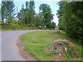
In Dufton
Looking towards the car park in the village
Image: © Michael Graham
Taken: 17 Jun 2010
0.02 miles
5
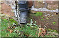
Benchmark on farm building
Ordnance Survey cut mark benchmark described on the Bench Mark Database at www.bench-marks.org.uk/bm91775
Image: © Roger Templeman
Taken: 19 Mar 2019
0.02 miles
6
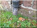
Ordnance Survey Cut Mark
This OS cut mark can be found on the barn at Lime Tree House. It marks a point 189.055m above mean sea level.
Image: © Adrian Dust
Taken: 25 Oct 2023
0.02 miles
7
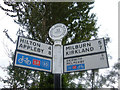
Route 68 road sign
Located close to the entrance to the camp site in Dufton. Route 68 is the longest of the Sustrans Cycle Routes. It starts at Derby and ends at Berwick-on-Tweed. Dufton is at the end of the South Pennine section.
Image: © michael ely
Taken: 30 Jul 2008
0.03 miles
9
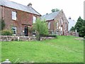
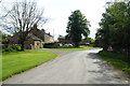
Dufton and Knock Methodist Church
Church is the building on the right.
Image: © Oliver Dixon
Taken: 15 Aug 2006
0.04 miles
10
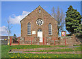
Dufton and Knock Methodist Church
Built in the local red sandstone.
Image: © John Illingworth
Taken: 22 Apr 2009
0.04 miles