
IMAGES TAKEN NEAR TO
Long Marton, APPLEBY-IN-WESTMORLAND, CA16 6BU
Introduction
This page details the photographs taken nearby to CA16 6BU by members of the Geograph project.
The Geograph project started in 2005 with the aim of publishing, organising and preserving representative images for every square kilometre of Great Britain, Ireland and the Isle of Man.

There are currently over 7.5m images from over14,400 individuals and you can help contribute to the project by visiting https://www.geograph.org.uk
Image Map
Images are licensed for reuse under creativecommons.org/licenses/by-sa/2.0
Notes
- Clicking on the map will re-center to the selected point.
- The higher the marker number, the further away the image location is from the centre of the postcode.
Image Listing (18 Images Found)
Images are licensed for reuse under creativecommons.org/licenses/by-sa/2.0
Image
Details
Distance
1
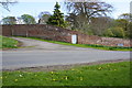
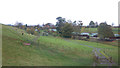
Road junction at north end of Long Marton
The minor road goes past Marton House
Image: © Roger Templeman
Taken: 7 May 2015
0.03 miles
6
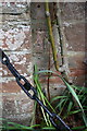
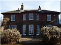
Benchmark on 'The Lodge'
Ordnance Survey cut mark benchmark described on the Bench Mark Database at http://www.bench-marks.org.uk/bm66552
Image: © Roger Templeman
Taken: 7 May 2015
0.11 miles
7
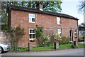
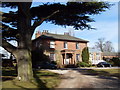
'The Lodge'
There is an OS benchmark Image on the left hand corner of the house where a stone wall abuts, and behind a rose bush
Image: © Roger Templeman
Taken: 7 May 2015
0.12 miles
8
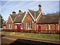
Former railway station, Long Marton
This is on the Settle-Carlisle line; it closed in 1970, but has been restored as holiday accommodation.
Image: © Humphrey Bolton
Taken: 3 Nov 2006
0.16 miles
9
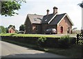
Long Marton railway station (site), Cumbria
Opened in 1876 by the Midland Railway on the line from Settle to Carlisle, this station closed in 1970. Forecourt.
Image: © Nigel Thompson
Taken: 14 Jul 2013
0.18 miles
10
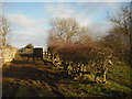
Railway bridge north-west of Long Marton
A railway bridge across the Settle-Carlisle line, viewed from a public footpath which runs alongside the field boundary on the right. The footpath makes a sharp turn to the left before the bridge which it does not cross. The field boundary on the right is obviously an old property boundary and what is not clear from the photograph is that the bridge has a double track. The stone parapet on the right is a continuation of the property boundary with another track on its right.
Image: © Christopher Hall
Taken: 30 Dec 2014
0.20 miles