IMAGES TAKEN NEAR TO
Bolton, APPLEBY-IN-WESTMORLAND, CA16 6AY
Introduction
This page details the photographs taken nearby to CA16 6AY by members of the Geograph project.
The Geograph project started in 2005 with the aim of publishing, organising and preserving representative images for every square kilometre of Great Britain, Ireland and the Isle of Man.

There are currently over 7.5m images from over14,400 individuals and you can help contribute to the project by visiting https://www.geograph.org.uk
Image Map
Images are licensed for reuse under creativecommons.org/licenses/by-sa/2.0
Notes
- Clicking on the map will re-center to the selected point.
- The higher the marker number, the further away the image location is from the centre of the postcode.
Image Listing (9 Images Found)
Images are licensed for reuse under creativecommons.org/licenses/by-sa/2.0
Image
Details
Distance
1
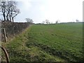
Farmland south of Edenbank Cottages
On the south side of the road from Bolton.
Image: © Christine Johnstone
Taken: 14 Feb 2017
0.03 miles
2
Roadside trees near Edenbank Cottages
Near the southern end of Crossrigg Lane.
Image: © Christine Johnstone
Taken: 14 Feb 2017
0.03 miles
3
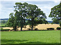
Field near Mansgrove Farm
Whinfell Forest (part hidden) on the skyline.
Image: © Oliver Dixon
Taken: 15 Jul 2015
0.05 miles
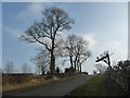
4
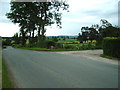
Road Junction
The junction of Crossrigg Lane with the Bolton to Cliburn
Image: © Alexander P Kapp
Taken: 30 Jun 2006
0.06 miles
5
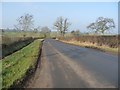
The road from Bolton to Cliburn and Penrith
Looking north-west, just west of the junction with Crossrigg Lane.
Image: © Christine Johnstone
Taken: 14 Feb 2017
0.07 miles
6
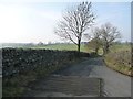
Trees on the lane to Street House
Without a gate, the cattle grid is no longer effective.
Image: © Christine Johnstone
Taken: 14 Feb 2017
0.08 miles
7
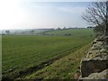
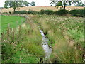
The valley of Coat Sike
About 120 metres above sea level. East of Street House.
Image: © Christine Johnstone
Taken: 14 Feb 2017
0.15 miles
8
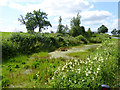
Roadside pond
A roadside pond, choked with weed. The roof of Mansgrove Farm can be seen on the skyline.
Image: © Oliver Dixon
Taken: 15 Jul 2015
0.20 miles