IMAGES TAKEN NEAR TO
Whinfell Road, APPLEBY-IN-WESTMORLAND, CA16 6AT
Introduction
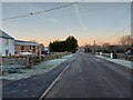
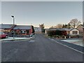
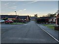
This page details the photographs taken nearby to Whinfell Road, CA16 6AT by members of the Geograph project.
The Geograph project started in 2005 with the aim of publishing, organising and preserving representative images for every square kilometre of Great Britain, Ireland and the Isle of Man.

There are currently over 7.5m images from over14,400 individuals and you can help contribute to the project by visiting https://www.geograph.org.uk
Image Map
Images are licensed for reuse under creativecommons.org/licenses/by-sa/2.0
Notes
- Clicking on the map will re-center to the selected point.
- The higher the marker number, the further away the image location is from the centre of the postcode.
Image Listing (9 Images Found)
Images are licensed for reuse under creativecommons.org/licenses/by-sa/2.0
Image
Details
Distance
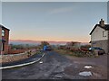
2
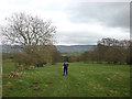
On the footpath to Bolton Mill
The North Pennines visible in the distance.
Image: © Karl and Ali
Taken: 10 Mar 2012
0.14 miles
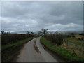
4
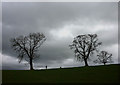
Trees above Luz Beck
By the footpath to Bolton
Image: © Karl and Ali
Taken: 10 Mar 2012
0.22 miles