IMAGES TAKEN NEAR TO
Slee Croft, APPLEBY-IN-WESTMORLAND, CA16 6AS
Introduction
This page details the photographs taken nearby to Slee Croft, CA16 6AS by members of the Geograph project.
The Geograph project started in 2005 with the aim of publishing, organising and preserving representative images for every square kilometre of Great Britain, Ireland and the Isle of Man.

There are currently over 7.5m images from over14,400 individuals and you can help contribute to the project by visiting https://www.geograph.org.uk
Image Map
Images are licensed for reuse under creativecommons.org/licenses/by-sa/2.0
Notes
- Clicking on the map will re-center to the selected point.
- The higher the marker number, the further away the image location is from the centre of the postcode.
Image Listing (50 Images Found)
Images are licensed for reuse under creativecommons.org/licenses/by-sa/2.0
Image
Details
Distance
1
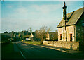
The chapel in Chapel Street, Bolton
Looking north-west from South End.
Image: © Christine Johnstone
Taken: 14 Feb 2017
0.03 miles
2
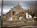
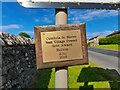
Bolton Methodist Church
A weathered panel below the cross seems to read 1818. It was restored in 1926.
Image: © Karl and Ali
Taken: 10 Mar 2012
0.03 miles
3
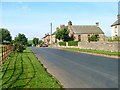
Bolton
View south west from crossroads.
Image: © Mick Garratt
Taken: 3 Sep 2005
0.04 miles
4
Bolton
View north east from crossroads.
Image: © Mick Garratt
Taken: 3 Sep 2005
0.04 miles
6
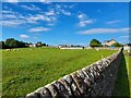
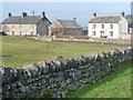
The Outskirts of Bolton
Farmland at the edge of the village.
Image: © David Bremner
Taken: 22 Jun 2022
0.04 miles
7
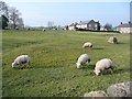
Sheep grazing in Bolton
Alongside an erratic boulder.
Image: © Christine Johnstone
Taken: 14 Feb 2017
0.05 miles
8
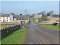
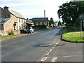
The crossroads, Bolton
Looking from South End to North End, with Chapel Street crossing.
Image: © Christine Johnstone
Taken: 14 Feb 2017
0.05 miles
10
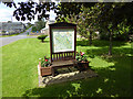
Village green, Bolton
Two benches, back to back, on the village green. On one side of the board is a map of the entire parish, on the other a more detailed map of the village with further information about the locality.
Image: © Oliver Dixon
Taken: 15 Jul 2015
0.06 miles