IMAGES TAKEN NEAR TO
Norman Terrace, MARYPORT, CA15 8EB
Introduction
This page details the photographs taken nearby to Norman Terrace, CA15 8EB by members of the Geograph project.
The Geograph project started in 2005 with the aim of publishing, organising and preserving representative images for every square kilometre of Great Britain, Ireland and the Isle of Man.

There are currently over 7.5m images from over14,400 individuals and you can help contribute to the project by visiting https://www.geograph.org.uk
Image Map
Images are licensed for reuse under creativecommons.org/licenses/by-sa/2.0
Notes
- Clicking on the map will re-center to the selected point.
- The higher the marker number, the further away the image location is from the centre of the postcode.
Image Listing (60 Images Found)
Images are licensed for reuse under creativecommons.org/licenses/by-sa/2.0
Image
Details
Distance
1
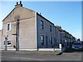
The junction of Ellenborough Place and Hutton Street
A small suburb of Maryport south of the River Ellen and west of the A596. The grassy parkland which now surrounds it was once railway lines and ironworks.
Image: © Christine Johnstone
Taken: 28 Feb 2013
0.01 miles
2
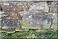
Ordnance Survey Cut Mark
This OS cut mark can be found on the wall SW side of the track. It marks a point 9.580m above mean sea level.
Image: © Adrian Dust
Taken: 27 Mar 2018
0.04 miles
4
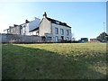
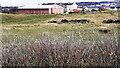
Houses on Ellenborough Place
Facing open ground along the River Ellen, at the junction with Ropery Street.
Image: © Christine Johnstone
Taken: 28 Feb 2013
0.08 miles
6
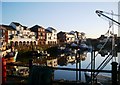
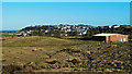
Looking towards the town from the coast path at Maryport
Image: © Roger Templeman
Taken: 28 Oct 2023
0.10 miles
7
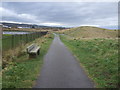
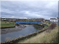
National Cycle Route 72 heading out of Maryport
Image: © JThomas
Taken: 23 Nov 2019
0.11 miles
8
Maryport View
A mid-December view, looking towards the town from the network of footpaths along the coast.
Image: © Mary and Angus Hogg
Taken: 15 Dec 2017
0.14 miles
9
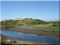
Motte Hill, Maryport
Site of a 12th century castle built on a bend in the River Ellen.
Image: © Tim Heaton
Taken: 30 Aug 2010
0.15 miles