1
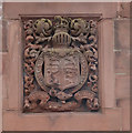
"Vinnie's Bar", Finkle Street
Originally built as the "Ye Apple Tree" public house.
Image: © Jim Osley
Taken: 27 Jun 2014
0.03 miles
2
Brow Top Car Park
This is on an area of land between the town and River Derwent, called the Cloffocks. Plans have been approved to build a Tesco Extra superstore on the spot below, with a car park covering much of the grassy area beyond. The development is highly controversial because the Cloffocks has traditionally been used for recreation, most famously the annual "Uppies and Downies" mass football game http://www.uppiesanddownies.info/index.html .
Image: © Rose and Trev Clough
Taken: 28 Aug 2010
0.03 miles
3
Ye Apple Tree Inn, Finkle Street, Workington
Image: © Alexander P Kapp
Taken: 3 Sep 2007
0.04 miles
4
Finkle Street, Workington
Heading WNW - the Methodist Church is in the distance
On the left is Carnegie Theatre at the corner with Warwick Place
Image: © Kenneth Allen
Taken: 20 Apr 2013
0.04 miles
5
Finkle Street, Workington
Looking down Finkle Street, Workington.
Image: © Graham Robson
Taken: 14 Jul 2012
0.05 miles
6
Carnegie Theatre and Arts Centre, Workington
The theatre was originally a hall, and the arts centre was a library, opened in 1904. This is recorded on a plaque http://www.geograph.org.uk/photo/2095969 inside the arts centre, part of which is now used as a community cafe (brilliant chips).
The library and hall were "built by the munificence of Andrew Carnegie...who gave £7,500 for the purpose". Carnegie was a Scot who became a steel magnate in the USA, later donating vast sums for philanthropic work http://www.spartacus.schoolnet.co.uk/USAcarnegie.htm . This included the building of some 3,000 libraries in the English-speaking world.
Image: © Rose and Trev Clough
Taken: 28 Aug 2010
0.05 miles
7
Finkle Street, Workington
Heading WNW
Image: © Kenneth Allen
Taken: 20 Apr 2013
0.05 miles
8
Commemorative plaque, Workington's Carnegie Library
Inside the building which is now the Carnegie Arts Centre on Finkle Street. For information and location, see
Image .
Image: © Rose and Trev Clough
Taken: 28 Aug 2010
0.05 miles
9
Royal coat of arms, Workington
Decorative feature of
Image
Image: © Jim Osley
Taken: 27 Jun 2014
0.05 miles
10
Former post office, Workington
The building dates from c. 1915 and was designed by Office of Works architect Charles Wilkinson. Like many an urban post office it no longer performs its original function having been converted into a betting shop. A particular feature of the building is the presence of the Royal coat of arms on the second floor.
Image: © Jim Osley
Taken: 27 Jun 2014
0.05 miles


