1
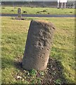
National Cycle Route 72, Siddick
Beside the Cumbrian Coast Line.
Towards Workington.
Image: © JThomas
Taken: 23 Nov 2019
0.06 miles
2
National Cycle Route 72 towards Workington
Image: © JThomas
Taken: 23 Nov 2019
0.06 miles
3
Siddick (Junction) railway station (site), Cumbria
Opened in 1880 by the London & North Western Railway on the line from Barrow-in-Furness to Carlisle, this station closed in 1934. View south west towards Workington and Barrow.
Only old maps show this was the site, where the view of the track disappears. No trace remains, unless the small hump to the right of the track is the remains of a platform.
Image: © Nigel Thompson
Taken: 14 Jul 2013
0.07 miles
4
Cumbrian Coast Line near Siddick
Towards Workington.
Image: © JThomas
Taken: 23 Nov 2019
0.08 miles
5
Fly tipped rubbish near the Cumbrian Coast Line, Siddick
Image: © JThomas
Taken: 23 Nov 2019
0.08 miles
6
Path beside the Cumbrian Coast Line
Image: © JThomas
Taken: 23 Nov 2019
0.08 miles
7
Old Milestone by the A596 in Siddick
Carved stone post by the A596, in parish of WORKINGTON (ALLERDALE District), Siddick, entrance to Iggesund Mill, by the road, on East side of road. Wigton curved red stone, erected by the Cockermouth & Maryport turnpike trust in the 19th century.
Inscription once read:-
: (WIGTON 21) : : (WORKINGTON 2) :
Carved benchmark and rivet on top.
Milestone Society National ID: CU_WOMP01.
Image: © CF Smith
Taken: 19 Feb 2010
0.10 miles
8
Old Milestone by the A596, Siddick, Workington parish
Wigton curved red stone by the A596, in parish of Workington (Allerdale District), Siddick, at entrance to Iggesund Mill, by the road.
Inscription once read:-
(Wigton)
(21)
(Workington)
(2)
Surveyed
Milestone Society National ID: CU_WGWO21
Image: © Milestone Society
Taken: Unknown
0.10 miles
9
Old Milestone by the A596, Siddick, Workington parish
Wigton curved red stone by the A596, in parish of Workington (Allerdale District), Siddick, at entrance to Iggesund Mill, by the road.
Inscription once read:-
(Wigton)
(21)
(Workington)
(2)
Surveyed
Milestone Society National ID: CU_WGWO21
Image: © Barbara Todd
Taken: 1 Nov 2023
0.10 miles
10
A596 Wedgwood Street, Siddick
Image: © Colin Pyle
Taken: 5 Sep 2021
0.11 miles


