IMAGES TAKEN NEAR TO
Pennine Way, CARLISLE, CA1 3QJ
Introduction
This page details the photographs taken nearby to Pennine Way, CA1 3QJ by members of the Geograph project.
The Geograph project started in 2005 with the aim of publishing, organising and preserving representative images for every square kilometre of Great Britain, Ireland and the Isle of Man.

There are currently over 7.5m images from over14,400 individuals and you can help contribute to the project by visiting https://www.geograph.org.uk
Image Map
Images are licensed for reuse under creativecommons.org/licenses/by-sa/2.0
Notes
- Clicking on the map will re-center to the selected point.
- The higher the marker number, the further away the image location is from the centre of the postcode.
Image Listing (34 Images Found)
Images are licensed for reuse under creativecommons.org/licenses/by-sa/2.0
Image
Details
Distance
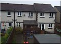
1

#3 Linden Terrace
Ordnance Survey records indicate the presence of a benchmark on a brick post in 1972 at a works enclosure. I assume the 'works' refers to an electricity substation. There are brick gateposts at the entrance to an EES left of the house, but no sign of a benchmark on them. See www.bench-marks.org.uk/bm113573
Image: © Luke Shaw
Taken: 28 Nov 2019
0.08 miles
2
Security fencing for Newman Catholic School on south side of Pennine Way
Previously there was a wall here with an Ordnance Survey benchmark, see https://www.bench-marks.org.uk/bm113440
Image: © Luke Shaw
Taken: 18 Nov 2019
0.13 miles
3
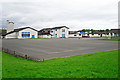
Pennine Way Primary School (1)
View across the playground, from Tindale Drive.
The school opened in the mid 1950s. This site was vacated in December 2015, when the school relocated to a new building on Edgehill Road.
Image: © Rose and Trev Clough
Taken: 24 May 2015
0.14 miles
4
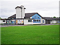
Pennine Way Primary School (2)
One of the entrances to the building, seen from Tindale Drive.
The school opened in the mid 1950s. This site was vacated in December 2015, when the school relocated to a new building on Edgehill Road.
Image: © Rose and Trev Clough
Taken: 24 May 2015
0.14 miles
7
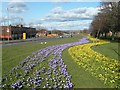
Eastern Way, Carlisle
This road between Harraby and Botcherby was constructed as part of a 1960's ring road scheme for the city, which never got completed. Buildings on the left are at Durranhill Industrial Estate, on the right is the Harraby housing estate.
Image: © Rose and Trev Clough
Taken: 4 Mar 2008
0.17 miles

9
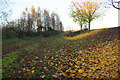
Waste ground on west side of Eastern Way at Durranhill Bridge
There was a bridge over the railway lines here before replaced by the Eastern Way bridge: see https://www.bench-marks.org.uk/bm113438 for details of an Ordnance Survey benchmark which was on the parapet of the original bridge
Image: © Luke Shaw
Taken: 18 Nov 2019
0.18 miles
10
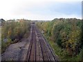
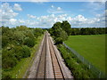
Railway tracks viewed from Durranhill Bridge
Looking from Durranhill Bridge along railway tracks towards Carlisle city Centre.
Image: © Graham Robson
Taken: 3 Nov 2013
0.18 miles