IMAGES TAKEN NEAR TO
Blindcrake, COCKERMOUTH, CA13 0QP
Introduction
This page details the photographs taken nearby to CA13 0QP by members of the Geograph project.
The Geograph project started in 2005 with the aim of publishing, organising and preserving representative images for every square kilometre of Great Britain, Ireland and the Isle of Man.

There are currently over 7.5m images from over14,400 individuals and you can help contribute to the project by visiting https://www.geograph.org.uk
Image Map
Images are licensed for reuse under creativecommons.org/licenses/by-sa/2.0
Notes
- Clicking on the map will re-center to the selected point.
- The higher the marker number, the further away the image location is from the centre of the postcode.
Image Listing (10 Images Found)
Images are licensed for reuse under creativecommons.org/licenses/by-sa/2.0
Image
Details
Distance
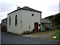
1
Blindcrake
Looking south, on the road to Isel. Gill Beck is on the right.
The temporary 'Works access 150 yards' sign refers to the recently installed United Utilities Thirlmere to West Cumbria pipeline.
Image: © Ian Taylor
Taken: 1 Dec 2021
0.03 miles
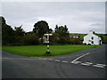
2
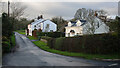
The centre of Blindcrake
Blindcrake village is about 4 miles northeast of Cockermouth, well above the Derwent Valley. A mediaeval strip field system remains in the northwest sector of Blindcrake. Its name is an anglicised version of the celtic Blaen-craig (summit of a rocky outcrop). In 2001 287 people lived here, in 69 houses. There are four working farms in the village.
Image: © Christine Johnstone
Taken: 26 Mar 2018
0.04 miles
3
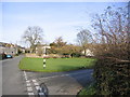
Blindcrake village green.
The motorist will have to rely on the goalkeeper's safe pair of hands when there is a game on.
Image: © Alexander P Kapp
Taken: 3 Sep 2007
0.06 miles
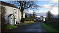
4

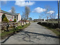
Blindcrake, looking south-west
This is the main road through the village.
Image: © Christine Johnstone
Taken: 26 Mar 2018
0.07 miles
5
Blindcrake village green.
The house on the left is being re roofed but I agree it looks derelict.
Image: © John Holmes
Taken: 19 Nov 2005
0.07 miles
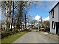
6
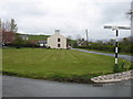
Blindcrake
Looking west along unnamed road, towards the village green.
Image: © Ian Taylor
Taken: 1 Dec 2021
0.08 miles
8
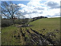
Sheep pasture at Blindcrake
Much of the farmland around the village is divided into small narrow fields.
Image: © Christine Johnstone
Taken: 26 Mar 2018
0.10 miles
9
Blindcrake, looking north-east
This is the main road through the village, mostly only developed on the west side.
Image: © Christine Johnstone
Taken: 26 Mar 2018
0.13 miles