1
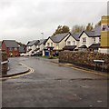
Lamplugh Road, Cockermouth
Lamplugh Road, or the A5086.
Image: © Graham Robson
Taken: 6 Nov 2014
0.04 miles
2
St Joseph's Catholic Primary School, Cockermouth
The site and buildings of St Joseph's Catholic Primary School viewed from The Level.
Image: © Graham Robson
Taken: 6 Nov 2014
0.06 miles
3
Sullart Street, Cockermouth
Houses on Sullart Street in the Cumbrian town of Cockermouth. This image was taken at dusk on a late November day.
Image: © Malc McDonald
Taken: 26 Nov 2022
0.06 miles
4
Woodville Park, Cockermouth
New housing estate, Woodville Park, just off Sullart Street, Cockermouth.
Image: © Richard Thomas
Taken: 27 Oct 2014
0.09 miles
5
Fairfield School in 1986
The school is situated off Gallowbarrow. This view looks towards the town with the spire of All Saints Church visible on the far right.
Image: © John Baker
Taken: 11 Sep 1986
0.12 miles
6
Christ Church Cockermouth
Christ Church Cockermouth looking east showing the reordered interior, with pews removed which was completed in 2009. The east wall has been repainted to match the rest of the interior walls and screens and lighting installed.
Image: © Gareth Browning
Taken: 5 Jul 2018
0.12 miles
7
Christ Church Cockermouth
Looking west inside Christ Church Cockermouth showing the modern layout with the pews removed which was completed in 2009 just before the 2009 floods.
Image: © Gareth Browning
Taken: 5 Jul 2018
0.12 miles
8
Christ Church Rooms
View inside the rooms looking north
Image: © Gareth Browning
Taken: 5 Jul 2018
0.12 miles
9
Christ Church Rooms
Looking south inside the rooms showing new floor completed and new windows completed in the last 5 years.
Image: © Gareth Browning
Taken: 5 Jul 2018
0.13 miles
10
Fletcher Street east, Cockermouth
The eastern side of Fletcher Street, Cockermouth. The houses at the end of the road are actually 37-39 Derwent Street.
Image: © Richard Thomas
Taken: 16 Jan 2012
0.15 miles


