IMAGES TAKEN NEAR TO
North Ridge, COCKERMOUTH, CA13 0DE
Introduction
This page details the photographs taken nearby to North Ridge, CA13 0DE by members of the Geograph project.
The Geograph project started in 2005 with the aim of publishing, organising and preserving representative images for every square kilometre of Great Britain, Ireland and the Isle of Man.

There are currently over 7.5m images from over14,400 individuals and you can help contribute to the project by visiting https://www.geograph.org.uk
Image Map
Images are licensed for reuse under creativecommons.org/licenses/by-sa/2.0
Notes
- Clicking on the map will re-center to the selected point.
- The higher the marker number, the further away the image location is from the centre of the postcode.
Image Listing (9 Images Found)
Images are licensed for reuse under creativecommons.org/licenses/by-sa/2.0
Image
Details
Distance
1
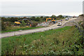
Entrance to Derwent Forest
A road with utilities is being built to open up part of this site for self-build houses.
Image: © Bill Boaden
Taken: 27 Aug 2019
0.09 miles
2
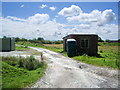
Building
To be found in the confounds of the disused munitions factory
Image: © Alexander P Kapp
Taken: 1 Aug 2007
0.15 miles
3
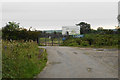
Delivering the Utropia vision
This is the site of the former armaments depot RNAD Broughton Moor. The vision proposes eco development on the site including self-build houses. Work on the infrastructure for the housing has already begun not far from here.
Some background is here: http://www.cumbriachamberofcommerce.co.uk/cumbrian-eco-scheme-can-lead-the-world/
Image: © Bill Boaden
Taken: 27 Aug 2019
0.16 miles
4
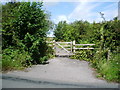
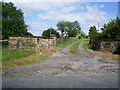
Gate
Access point to private woodland to which the public have been given access.
Image: © Alexander P Kapp
Taken: 1 Aug 2007
0.16 miles
5

Bus stop on Church Road
The bus stop and the pavement are both unusual for a minor country road, but are relics from the former armaments depot which adjoined the road.
Image: © Bill Boaden
Taken: 27 Aug 2019
0.19 miles
6
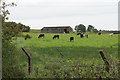
Cattle at RNAD Broughton Moor
These cattle are within the boundary of the former armaments depot which was closed in 1992.
Image: © Bill Boaden
Taken: 27 Aug 2019
0.21 miles
7
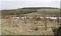
Small Pond on Reclaimed Opencast Land
One of a pair of small ponds, close to a new footpath, and not yet on OS maps.The large opencast coal workings have been landscaped and planted with trees by the Forestry Commission. Some of the old access roads have been retained and some new paths created. The public are welcome, but no motorised vehicles.
Image: © Bob Jenkins
Taken: 14 Mar 2007
0.21 miles
8
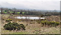
Small Pond on Reclaimed Opencast Land
One of a pair of small ponds, close to a new footpath, and not yet on OS maps.The large opencast coal workings have been landscaped and planted with trees by the Forestry Commission. Some of the old access roads have been retained and some new paths created. The public are welcome, but no motorised vehicles.
Image: © Bob Jenkins
Taken: 14 Mar 2007
0.21 miles