1
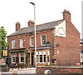
Houses of Grey Street at Flower Street junction
There is an Ordnance Survey benchmark
Image on the right hand end of the white skirt which runs along the base of the houses
Image: © Roger Templeman
Taken: 30 Jul 2021
0.04 miles
2
Benchmark on #25 Grey Street
Ordnance Survey cut mark benchmark described on the Bench Mark Database at http://www.bench-marks.org.uk/bm24454
Image: © Roger Templeman
Taken: 12 Jun 2011
0.04 miles
3
Ordnance Survey Cut Mark
This OS cut mark can be found on No25 Grey Street. It marks a point 18.745m above mean sea level.
Image: © Adrian Dust
Taken: 11 Apr 2016
0.04 miles
4
The Cranemakers, Carlisle - August 2016
Built circa 1840 and originally "The Carlton" hotel, it became "The Theakston" public house in 1981. The name was changed to "The Cranemakers" in 1990 after the demise of Cowans, Sheldon & Co., whose works were across the road (demolished 1989 and now retail outlets).
The building is Grade II listed.
The pub web sites gives an interesting potted history of Cowans, Sheldon : http://thecranies.webs.com/history.htm
Photograph is for record only - I have no connection with this business and all queries should be directed through the pub web site.
Image: © The Carlisle Kid
Taken: 9 Aug 2016
0.04 miles
5
St Nicholas Arms public house
Located on the London Road (A6) at the junction with Grey Street.
Image: © Richard Dorrell
Taken: 25 Jul 2011
0.04 miles
6
St Nicholas Arms on London Road
Image: © Ian S
Taken: 24 Aug 2013
0.04 miles
7
St Nicholas Arms, London Road, Carlisle - September 2016
Opened by the State Management Board in 1921, the St Nicholas Arms
was sold to the John Smiths Brewing Group on 9 May 1973. Still trading.
Photograph is for record only - I have no connection with this business and cannot advise on its products or services.
Image: © The Carlisle Kid
Taken: 13 Sep 2016
0.04 miles
8
St Nicholas Arms pub at Grey Street / London Road junction
There is an Ordnance Survey benchmark
Image on the wall pier, left hand face, at the wall corner, right of the Grey Street name sign
Image: © Roger Templeman
Taken: 19 Aug 2019
0.04 miles
9
Former "Beerhouse Off-Licence", Orchard Street, Carlisle - December 2018
This unassuming late 19th Century terrace house at 34 Orchard Street was once the "Beerhouse Off-Licence". It was acquired by the State Management Scheme on 1 November 1916 and probably instantly closed. There are signs of alterations around the ground floor window which may date from its conversion to a private dwelling.
Private dwelling with no public access.
Image: © The Carlisle Kid
Taken: 22 Dec 2018
0.04 miles
10
The Cranemakers public house
Located in the London Road (A6) at the junction with Grey Street. There are three pubs at this road junction. Thirsty place?
Image: © Richard Dorrell
Taken: 25 Jul 2011
0.05 miles


