
IMAGES TAKEN NEAR TO
Greystone Road, CARLISLE, CA1 2DB
Introduction
This page details the photographs taken nearby to Greystone Road, CA1 2DB by members of the Geograph project.
The Geograph project started in 2005 with the aim of publishing, organising and preserving representative images for every square kilometre of Great Britain, Ireland and the Isle of Man.

There are currently over 7.5m images from over14,400 individuals and you can help contribute to the project by visiting https://www.geograph.org.uk
Image Map
Images are licensed for reuse under creativecommons.org/licenses/by-sa/2.0
Notes
- Clicking on the map will re-center to the selected point.
- The higher the marker number, the further away the image location is from the centre of the postcode.
Image Listing (73 Images Found)
Images are licensed for reuse under creativecommons.org/licenses/by-sa/2.0
Image
Details
Distance
1
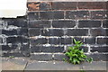
Benchmark on #103 Greystone Road
Ordnance Survey cut mark benchmark described on the Bench Mark Database at http://www.bench-marks.org.uk/bm38294
Image: © Roger Templeman
Taken: 12 Jun 2011
0.06 miles
2
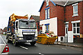
Skip wagon in Greystone Road
Three days after floodwater swamped hundreds of properties in the Warwick Road area of Carlisle, people had started piling up the ruined contents outside. Skips to dispose of these items were being delivered, a few already filled were being taken away.
Image: © Rose and Trev Clough
Taken: 9 Dec 2015
0.07 miles
3
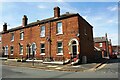
Houses on Greystone Road at Jackson Street junction
There is an Ordnance Survey benchmark Image on the right hand side of the house at the corner at the junction of the house with an abutting low brick wall topped with white stones
Image: © Luke Shaw
Taken: 24 Aug 2019
0.08 miles
4
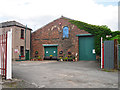
Irving's Coaches, depot entrance
In Jesmond Street, off Greystone Road.
For many years this site was in industrial use, starting in 1851 when the Raven Nook woollen mill opened.
Image: © Rose and Trev Clough
Taken: 5 Jul 2015
0.09 miles
5
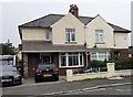
Nos. 8 and 10 Brunton Avenue
There is an Ordnance Survey benchmark Image on the front of the left hand house at its left hand corner, behind the brick pillar.
Image: © Roger Templeman
Taken: 16 Oct 2021
0.10 miles
6
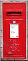
GR VI Postbox, Carlisle
Box CA1 29 at Warwick Road post office.
Image: © David Rogers
Taken: 13 Nov 2009
0.10 miles
7
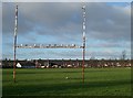
Playing field, Melbourne Park
Houses behind the field are on Greystone Road.
Image: © Rose and Trev Clough
Taken: 16 Jan 2008
0.10 miles
8
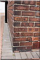
Benchmark on #8 Brunton Avenue
Ordnance Survey cut mark benchmark described on the Bench Mark Database at http://www.bench-marks.org.uk/bm38293
Image: © Roger Templeman
Taken: 12 Jun 2011
0.10 miles
9
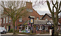
The Beehive, Warwick Road, Carlisle - April 2017 (1)
The original Beehive (the two-storey building at left) dates from 1849-64 and was first recorded as a pub in 1872 when owned by Iredale's Brewery and occupied by a Robert Irvine. The single storey building is a later addition.
Acquired by the State Management Scheme on 15 August 1916, it was sold to John Smiths Brewing Group on 7 May 1973. Still trading.
See also: Image] .
Photograph is for record only - I have no connection with this business and cannot advise on its products or services.
Image: © The Carlisle Kid
Taken: 6 Apr 2017
0.12 miles
10
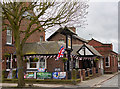
The Beehive, Warwick Road, Carlisle - April 2017 (2)
For information on this building, see: Image] .
Image: © The Carlisle Kid
Taken: 6 Apr 2017
0.12 miles