IMAGES TAKEN NEAR TO
St. Johns Old School, Church Lane, KESWICK, CA12 5PZ

Introduction

This page details the photographs taken nearby to St. Johns Old School, Church Lane, CA12 5PZ by members of the Geograph project.

The Geograph project started in 2005 with the aim of publishing, organising and preserving representative images for every square kilometre of Great Britain, Ireland and the Isle of Man.

There are currently over 7.5m images from over14,400 individuals and you can help contribute to the project by visiting https://www.geograph.org.uk

Image Map


Images are licensed for reuse under creativecommons.org/licenses/by-sa/2.0
Notes
  • Clicking on the map will re-center to the selected point.
  • The higher the marker number, the further away the image location is from the centre of the postcode.

Image Listing (598 Images Found)

Images are licensed for reuse under creativecommons.org/licenses/by-sa/2.0
  • ...
Image
Details
Distance
1
The Old School, St John's Road
Image: © Basher Eyre Taken: 17 Feb 2015
0.00 miles
2
Looking from St John's Street into Church Street
Image: © Basher Eyre Taken: 17 Feb 2015
0.00 miles
3
St John's Street: datestone on the old school
Image: © Basher Eyre Taken: 17 Feb 2015
0.00 miles
4
Junction of Derwentwater Place and Church Street
Image: © Basher Eyre Taken: 17 Feb 2015
0.01 miles
5
Former Keswick Library, St John's Street
The plaque says 'Keswick Library 1849'. The building was subsequently extended with the addition of a hall, meeting room etc for community use, and called Battersby Hall. The public entrance to the hall was around the corner in Church Street - see photo http://www.geograph.org.uk/photo/5525510 . The cottage on the left, previously the caretaker's residence, is now a holiday let. Battersby Hall was sold in 2011, because the cost of upgrading to modern standards was too high. The building has been converted to housing.
Image: © Rose and Trev Clough Taken: 12 Aug 2017
0.01 miles
6
Remains of an old road warning sign
Located in St John's Street. A plate illustrating the potential hazard has been lost, but it was most likely for a school which has been closed for some time - see Image .
Image: © Rose and Trev Clough Taken: 12 Aug 2017
0.01 miles
7
The former Battersby Hall, Church Street
This was a community building which became outdated, last used by a pre-school until 2012. For more information see Image . The hall has been converted to residential units, for which a new doorway has been added on the left. Work appears to be still in progress on the right hand side.
Image: © Rose and Trev Clough Taken: 12 Aug 2017
0.02 miles
8
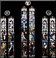
St John's church, Keswick, Cumbria - Window
Image: © John Salmon Taken: 12 Aug 2008
0.02 miles
9
Benchmark on north angle of 52 St John's Street
Ordnance Survey cut mark benchmark levelled at 89.348m above Newlyn Datum in 1969
Image: © Roger Templeman Taken: 8 Apr 2024
0.02 miles
10
#52 St John's Street at High Street junction
There is an Ordnance Survey benchmark Image on the front of the house at its right hand corner
Image: © Roger Templeman Taken: 8 Apr 2024
0.02 miles
  • ...