IMAGES TAKEN NEAR TO
Bassenthwaite, KESWICK, CA12 4RD
Introduction
This page details the photographs taken nearby to CA12 4RD by members of the Geograph project.
The Geograph project started in 2005 with the aim of publishing, organising and preserving representative images for every square kilometre of Great Britain, Ireland and the Isle of Man.

There are currently over 7.5m images from over14,400 individuals and you can help contribute to the project by visiting https://www.geograph.org.uk
Image Map
Images are licensed for reuse under creativecommons.org/licenses/by-sa/2.0
Notes
- Clicking on the map will re-center to the selected point.
- The higher the marker number, the further away the image location is from the centre of the postcode.
Image Listing (23 Images Found)
Images are licensed for reuse under creativecommons.org/licenses/by-sa/2.0
Image
Details
Distance
2
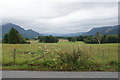
Farmland near Bassenthwaite
Looking up the Bassenthwaite valley from the bus stop by Armathwaite Hall.
Image: © Bill Boaden
Taken: 20 Jul 2019
0.10 miles
3
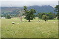
Sheep and cows near Armathwaite Hall
In the background, the cloud is lifting a bit on Ullock Pike.
Image: © Bill Boaden
Taken: 20 Jul 2019
0.11 miles
4
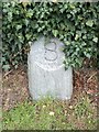
Old Milestone by the B5291, near Armathwaite Hotel
Carved stone post by the B5291, in parish of BASSENTHWAITE (ALLERDALE District), exit of Armathwaite Hall, on grass verge against wall, on West side of road. Cockermouth numeral, erected by the Keswick turnpike trust in the 19th century.
Inscription reads:-
8
(To Keswick)
Milestone Society National ID: CU_KWCM08
Image: © CF Smith
Taken: 15 Aug 2005
0.12 miles
5
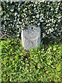
Old Milestone by the B5291, near Armathwaite Hotel
Carved stone post by the B5291, in parish of BASSENTHWAITE (ALLERDALE District), exit of Armathwaite Hall, on grass verge against wall, on West side of road. Cockermouth numeral, erected by the Keswick turnpike trust in the 19th century.
Inscription reads:-
8
(To Keswick)
Milestone Society National ID: CU_KWCM08
Image: © Barbara Todd
Taken: 16 Oct 2023
0.12 miles
6
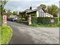
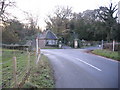
Armathwaite Hall Gateway and South Lodge
The exit gate of Armathwaite Hall. Formerly a private house, Armathwaite Hall is now a hotel.
There is an Ordnance Survey cut benchmark on the face of the right hand gatepost (detail photograph Image).
Image: © Adrian Taylor
Taken: 1 May 2022
0.12 miles
7
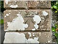
Benchmark, Armathwaite Hall Hotel Gate
Detail of an Ordnance Survey cut benchmark on the pillar of the exit gate of Armathwaite Hall Hotel. The benchmark marks a height of 87.6178m above mean sea level (Ordnance Datum Newlyn) last verified in 1969 (location photograph Image).
Image: © Adrian Taylor
Taken: 1 May 2022
0.12 miles
8
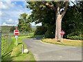
No Entry
Armathwaite Hall Hotel operates a one way traffic system on the drives within the hotel grounds.
Image: © Adrian Taylor
Taken: 9 Sep 2023
0.12 miles