IMAGES TAKEN NEAR TO
Windebrowe Avenue, KESWICK, CA12 4JQ
Introduction
This page details the photographs taken nearby to Windebrowe Avenue, CA12 4JQ by members of the Geograph project.
The Geograph project started in 2005 with the aim of publishing, organising and preserving representative images for every square kilometre of Great Britain, Ireland and the Isle of Man.

There are currently over 7.5m images from over14,400 individuals and you can help contribute to the project by visiting https://www.geograph.org.uk
Image Map
Images are licensed for reuse under creativecommons.org/licenses/by-sa/2.0
Notes
- Clicking on the map will re-center to the selected point.
- The higher the marker number, the further away the image location is from the centre of the postcode.
Image Listing (94 Images Found)
Images are licensed for reuse under creativecommons.org/licenses/by-sa/2.0
Image
Details
Distance
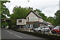
1
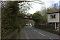
Former Keswick Railway Station
Now owned by an hotel and well maintained but sadly underused. Situated alongside the Keswick Railway Cyclepath it really has potential.
Image: © Mick Garratt
Taken: 16 Jul 2005
0.01 miles
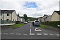
2
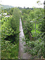
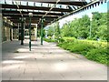
Footpath to school
A view from the cycle path along the former railway line outside Keswick, looking down along a footpath that leads from the main Penrith Road to a school.
Image: © Stephen Craven
Taken: 21 Jun 2011
0.11 miles
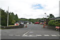
3
Keswick Sorting Office
On the south side of Penrith Road.
Image: © Christine Johnstone
Taken: 15 May 2015
0.13 miles
4
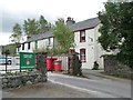
Low Brigham, Keswick
A short terrace of houses on the south side of Penrith Road,facing the former drill hall.
Image: © Christine Johnstone
Taken: 15 May 2015
0.13 miles
6
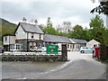
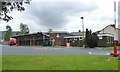
Keswick's former drill hall, south side
Once a World war One drill hall. Now home to both an outdoor activities hostel business and the Keswick Detachment of the Army Cadet Force.
Image: © Christine Johnstone
Taken: 15 May 2015
0.14 miles
9
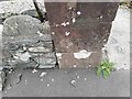
Ordnance Survey Cut Mark
This OS cut mark can be found on the gatepost of Denton House, Penrith Road. It marks a point 89.441m above mean sea level.
Image: © Adrian Dust
Taken: 14 Sep 2022
0.15 miles