IMAGES TAKEN NEAR TO
Glenridding, PENRITH, CA11 0PY
Introduction
This page details the photographs taken nearby to CA11 0PY by members of the Geograph project.
The Geograph project started in 2005 with the aim of publishing, organising and preserving representative images for every square kilometre of Great Britain, Ireland and the Isle of Man.

There are currently over 7.5m images from over14,400 individuals and you can help contribute to the project by visiting https://www.geograph.org.uk
Image Map
Images are licensed for reuse under creativecommons.org/licenses/by-sa/2.0
Notes
- Clicking on the map will re-center to the selected point.
- The higher the marker number, the further away the image location is from the centre of the postcode.
Image Listing (59 Images Found)
Images are licensed for reuse under creativecommons.org/licenses/by-sa/2.0
Image
Details
Distance
2
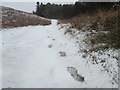
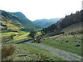
Single set of footprints in the snow
En route to Lanty’s Tarn from the Grisedale valley.
Image: © Peter S
Taken: 29 Dec 2017
0.12 miles
5
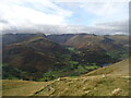
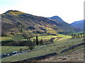
The entrance to Grisedale
Seen from high on Place Fell. The southern tip of Ullswater is on the right.
At the centre, the long, high background ridge leads right to the summit of Helvellyn. To its right is the pointed summit of Catstycam, and in front of these is the ridge leading from Striding Edge to Birkhouse Moor. On the far right is Raise, in Image
To the left of the photo the most conspicuous hill is St Sunday Crag, with the long ridge leading to Birks and Arnison Crag running towards the camera. Just left of St Sunday Crag a gentle slope leads to Gavel Pike, a fine viewpoint, in Image To complete the picture, on the far left are hills on the Fairfield Horseshoe.
Image: © Michael Earnshaw
Taken: 11 Oct 2024
0.13 miles
6
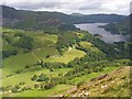
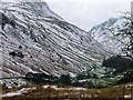
Grisedale
The foot of the valley that separates the Helvellyn and Fairfield groups of fells. This view from the fellside on Birks shows Ullswater.
Image: © Andrew Smith
Taken: 20 Jun 2008
0.13 miles
7
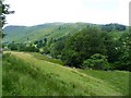
Grisedale Beck
From the road to Thornhow. Grisedale means 'valley where young pigs graze' and was first recorded here in the year 1291 as 'Crisdale'( Whaley 2006).
Image: © Michael Graham
Taken: 27 Jul 2010
0.13 miles
8
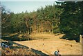
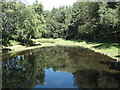
Lanty's Tarn
See Image for some history and explanation of the name.
Image: © Stephen Craven
Taken: 22 Mar 2003
0.14 miles
9
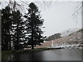
The dam at Lanty's Tarn
Lanty's Tarn was previously a smaller natural tarn.
Image: © Peter S
Taken: 29 Dec 2017
0.14 miles