IMAGES TAKEN NEAR TO
Newtongate, PENRITH, CA11 0BF
Introduction
This page details the photographs taken nearby to Newtongate, CA11 0BF by members of the Geograph project.
The Geograph project started in 2005 with the aim of publishing, organising and preserving representative images for every square kilometre of Great Britain, Ireland and the Isle of Man.

There are currently over 7.5m images from over14,400 individuals and you can help contribute to the project by visiting https://www.geograph.org.uk
Image Map
Images are licensed for reuse under creativecommons.org/licenses/by-sa/2.0
Notes
- Clicking on the map will re-center to the selected point.
- The higher the marker number, the further away the image location is from the centre of the postcode.
Image Listing (21 Images Found)
Images are licensed for reuse under creativecommons.org/licenses/by-sa/2.0
Image
Details
Distance

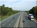
4
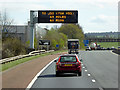
Variable Message Sign on the M6 near Penrith
Image: © David Dixon
Taken: 7 Apr 2017
0.12 miles
5
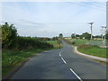
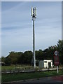
Newton Road
Heading north west by an electricity sub station.
Image: © JThomas
Taken: 10 Oct 2015
0.13 miles
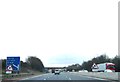
6
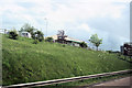
Up the bank to Gilwilly industrial estate
From southbound M6. The brown tourist sign can be seen to the right for junction 40
Image: © John Firth
Taken: 13 May 2011
0.13 miles
7
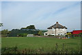
House off Newton Road
Near the M6 Motorway.
Image: © JThomas
Taken: 10 Oct 2015
0.13 miles
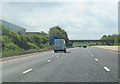
8
M6 northbound, Castletown
From the bridge on Newton Road.
Image: © JThomas
Taken: 10 Oct 2015
0.15 miles
9
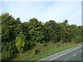
Woodland beside the M6, Castletown
From the bridge on Newton Road.
Image: © JThomas
Taken: 10 Oct 2015
0.16 miles