IMAGES TAKEN NEAR TO
Shap, PENRITH, CA10 3QW
Introduction
This page details the photographs taken nearby to CA10 3QW by members of the Geograph project.
The Geograph project started in 2005 with the aim of publishing, organising and preserving representative images for every square kilometre of Great Britain, Ireland and the Isle of Man.

There are currently over 7.5m images from over14,400 individuals and you can help contribute to the project by visiting https://www.geograph.org.uk
Image Map
Images are licensed for reuse under creativecommons.org/licenses/by-sa/2.0
Notes
- Clicking on the map will re-center to the selected point.
- The higher the marker number, the further away the image location is from the centre of the postcode.
Image Listing (16 Images Found)
Images are licensed for reuse under creativecommons.org/licenses/by-sa/2.0
Image
Details
Distance
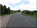
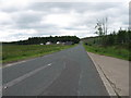
3
The A6 passing Shap Lodge
The Lodge is also the entrance for Shap Wells Hotel.
Image: © Nigel Brown
Taken: 23 Sep 2014
0.04 miles
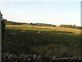
6
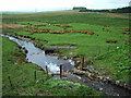
Blea Beck
Looking SE towards Shap Manor Hotel
Image: © Alexander P Kapp
Taken: 18 May 2006
0.13 miles
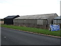
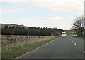
8
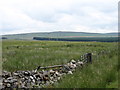
Country near the Shap Wells Hotel
Not very exciting, it must be admitted! But there is much better scenery within a short distance, whichever direction you go.
Image: © David Purchase
Taken: 25 Jul 2013
0.16 miles
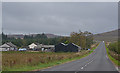
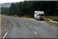
9
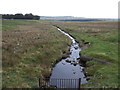
Blea Beck
View east from Tunnel Bridge on the A6.
Image: © JThomas
Taken: 22 Oct 2016
0.17 miles