
IMAGES TAKEN NEAR TO
Thrimby, PENRITH, CA10 3EA
Introduction
This page details the photographs taken nearby to CA10 3EA by members of the Geograph project.
The Geograph project started in 2005 with the aim of publishing, organising and preserving representative images for every square kilometre of Great Britain, Ireland and the Isle of Man.

There are currently over 7.5m images from over14,400 individuals and you can help contribute to the project by visiting https://www.geograph.org.uk
Image Map
Images are licensed for reuse under creativecommons.org/licenses/by-sa/2.0
Notes
- Clicking on the map will re-center to the selected point.
- The higher the marker number, the further away the image location is from the centre of the postcode.
Image Listing (9 Images Found)
Images are licensed for reuse under creativecommons.org/licenses/by-sa/2.0
Image
Details
Distance
4
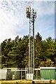
Thrimby Mill Plantation
Communications mast at Thrimby Mill Plantation.
Image: © Peter McDermott
Taken: 13 Oct 2024
0.09 miles
5
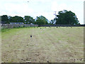
Rooks' dinner
Rooks gleaning on a freshly mown field. Moorriggs Farm Image beyond.
Image: © Oliver Dixon
Taken: 11 Jun 2014
0.16 miles
6
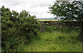
Trig point of Sheriffs Park
The trig point of Sheriffs Park in thick grass at the northern end of the small enclosure bounding Thimbly Mill Plantation.
Image: © Trevor Littlewood
Taken: 2 Jul 2004
0.24 miles
7
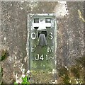
Flush Bracket Benchmark, Sheriff?s Park
Detail of the flush bracket benchmark on the Ordnance Survey triangulation pillar near Sheriff Park (photograph Image). The flush bracket, benchmark number 10416, is on the south-south-east face of the pillar and marks a height of 254.2204m above sea level (Ordnance Datum Newlyn), last verified in 1970.
Image: © Adrian Taylor
Taken: 3 Aug 2008
0.24 miles
8
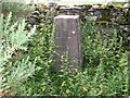
Triangulation Pillar, Sheriff?s Park
The Ordnance Survey triangulation pillar near Sheriff Park. The flush bracket benchmark number 10416 on the south-south-east face of the pillar marks a height of 254.2204m above sea level (Ordnance Datum Newlyn) last verified in 1970 (photograph Image).
Image: © Adrian Taylor
Taken: 3 Aug 2008
0.24 miles
9
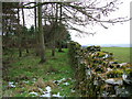
Edge of the wood near Sheriff Park
Sheriff Park Trig Pillar is just visible by the wall in the centre of the picture.
Image: © David Brown
Taken: 13 Feb 2009
0.25 miles