IMAGES TAKEN NEAR TO
Bampton, PENRITH, CA10 2RH

Introduction

This page details the photographs taken nearby to CA10 2RH by members of the Geograph project.

The Geograph project started in 2005 with the aim of publishing, organising and preserving representative images for every square kilometre of Great Britain, Ireland and the Isle of Man.

There are currently over 7.5m images from over14,400 individuals and you can help contribute to the project by visiting https://www.geograph.org.uk

Image Map


Images are licensed for reuse under creativecommons.org/licenses/by-sa/2.0
Notes
  • Clicking on the map will re-center to the selected point.
  • The higher the marker number, the further away the image location is from the centre of the postcode.

Image Listing (53 Images Found)

Images are licensed for reuse under creativecommons.org/licenses/by-sa/2.0
  • ...
Image
Details
Distance
1
House at Bomby
Image: © Oliver Dixon Taken: 11 Jun 2014
0.02 miles
2
ROC Bampton
This bunker was used by the Royal Observer Corps during the cold war to monitor and report nuclear activity.
Image: © Alan Pollock Taken: 3 May 2014
0.05 miles
3
Greengate near Bampton
Lake District farmhouse and buildings.
Image: © M J Richardson Taken: 3 Jul 2016
0.07 miles
4
Entrance to Bomby
Road junction at Bomby.
Image: © Colin Kinnear Taken: 7 Mar 2010
0.08 miles
5
Bomby Farm
Image: © David Brown Taken: 4 Sep 2011
0.09 miles
6
Houses at Bomby
And a very fine tree.
Image: © Oliver Dixon Taken: 12 Apr 2019
0.10 miles
7
Bomby, near Bampton Grange
Image: © David Purchase Taken: 25 Jul 2013
0.10 miles
8
Bomby Farm
Image: © Peter McDermott Taken: 13 Oct 2024
0.11 miles
9
Beck Bampton Grange
South bank of the River Lowther indicated by the trees on the left.
Image: © Michael Graham Taken: 19 May 2006
0.11 miles
10
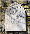
The Old Chapel Sign
This sign is on the wall of a building beside the Wesleyan Chapel built in 1877 and now appears to be now used as a house.
Image: © William England Taken: 31 Mar 2009
0.15 miles
  • ...