IMAGES TAKEN NEAR TO
Brougham, PENRITH, CA10 2AF
Introduction
This page details the photographs taken nearby to CA10 2AF by members of the Geograph project.
The Geograph project started in 2005 with the aim of publishing, organising and preserving representative images for every square kilometre of Great Britain, Ireland and the Isle of Man.

There are currently over 7.5m images from over14,400 individuals and you can help contribute to the project by visiting https://www.geograph.org.uk
Image Map
Images are licensed for reuse under creativecommons.org/licenses/by-sa/2.0
Notes
- Clicking on the map will re-center to the selected point.
- The higher the marker number, the further away the image location is from the centre of the postcode.
Image Listing (22 Images Found)
Images are licensed for reuse under creativecommons.org/licenses/by-sa/2.0
Image
Details
Distance
1
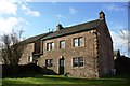
Whinfell House
Ordnance Survey records indicate that a benchmark was cut on the house in 1844. This is shown on the 1860 Map but not on maps from 1898. It appears that the buildings were modified with loss of the mark. See www.bench-marks.org.uk/bm67382
Image: © Luke Shaw
Taken: 4 Feb 2020
0.02 miles
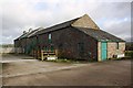
3
Whinfell House
Sits a few metres away from the very busy A66 trunk road.
Image: © Bob Jenkins
Taken: 28 Jan 2006
0.02 miles
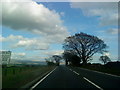
5
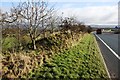
Earth bank beside A66 at approach to dual carriageway section
Ordnance Survey records show there was a gatepost with a benchmark at this location in 1972: apparently this has been lost to A66 development. See www.bench-marks.org.uk/bm115992
Image: © Luke Shaw
Taken: 4 Feb 2020
0.08 miles
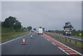
6
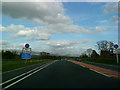
Start of the dual carriageway on the A66
Image: © Andrew Abbott
Taken: 15 May 2010
0.14 miles
7
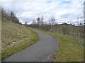
Cycle path descending from the A66 at Winderwath Farm
Allowing cyclists to use the former A66, rather than the dual carriageway Temple Sowerby by-pass [opened 2007].
Image: © Christine Johnstone
Taken: 26 Mar 2018
0.17 miles
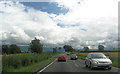
9
Approaching the end of the Temple Sowerby Bypass
Image: © N Chadwick
Taken: 23 Jun 2012
0.19 miles
10
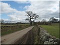
The road from Woodside to Winderwath
A narrow country lane running approximately parallel to the A66.
Image: © Christine Johnstone
Taken: 26 Mar 2018
0.20 miles