
IMAGES TAKEN NEAR TO
Stockmans Lane, BELFAST, BT9 7JB
Introduction
This page details the photographs taken nearby to Stockmans Lane, BT9 7JB by members of the Geograph project.
The Geograph project started in 2005 with the aim of publishing, organising and preserving representative images for every square kilometre of Great Britain, Ireland and the Isle of Man.

There are currently over 7.5m images from over14,400 individuals and you can help contribute to the project by visiting https://www.geograph.org.uk
Image Map
Images are licensed for reuse under creativecommons.org/licenses/by-sa/2.0
Notes
- Clicking on the map will re-center to the selected point.
- The higher the marker number, the further away the image location is from the centre of the postcode.
Image Listing (10 Images Found)
Images are licensed for reuse under creativecommons.org/licenses/by-sa/2.0
Image
Details
Distance
1
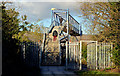
Railway footbridge, Balmoral, Belfast
A footbridge across the Belfast (right) – Portadown/Dublin railway. It connects the Upper Lisburn Road to Musgrave Park Hospital. Image shows the railway on the Belfast side.
Image: © Albert Bridge
Taken: 10 Dec 2012
0.12 miles
2
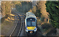
Train near Balmoral, Belfast
C4K set 4008 approaching this footbridge Image with the 10.27 Bangor – Portadown. Balmoral station Image is in the background, at upper left. Most of the line between Balmoral and Finaghy is well hidden behind suburban back gardens.
Image: © Albert Bridge
Taken: 10 Dec 2012
0.16 miles
3
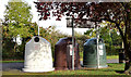
Recycling bins, Musgrave Park, Belfast (October 2014)
Recycling bins, all for glass, close to the bowling greens.
Image: © Albert Bridge
Taken: 13 Oct 2014
0.18 miles
4
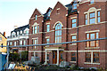
Unfinished apartments, Balmoral, Belfast
A block of unfinished apartments, on the Lisburn Road, almost opposite here Image
Image: © Albert Bridge
Taken: 10 Dec 2012
0.19 miles
5
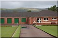
Bowling club
Bowls club situated in Musgrave Park. Divis Mountain and the mast of the BBC transmitter are in the background. http://www.belfastcity.gov.uk/parksandopenspaces/parksdetails.asp?id=95
Image: © Paul McIlroy
Taken: 18 May 2007
0.21 miles
6
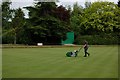
Musgrave Park
Cutting the grass on the bowling green.
Image: © Paul McIlroy
Taken: 18 May 2007
0.21 miles
7
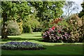
Musgrave Park
Opened in 1924, the grounds of Musgrave Park were donated to the residents of Belfast by Henry Musgrave, who lived in nearby Drumglass House
Image: © Paul McIlroy
Taken: 18 May 2007
0.23 miles
8
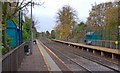
Balmoral station, Belfast (2007-1)
The line between Belfast and Lisburn opened in 1839. Balmoral station opened circa 1858. It was re-built in the 60’s when Stockman’s Lane Image was widened to become part of the Belfast outer ring road. The view is towards Lisburn/Dublin. For a later view see Image (December 2012).
Image: © Albert Bridge
Taken: 3 Nov 2007
0.23 miles
9
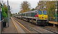
The "Enterprise" at Balmoral, Belfast
See Image The 07.35 Dublin – Belfast passing Balmoral station, at reduced speed following a signal check.
Image: © Albert Bridge
Taken: 3 Nov 2007
0.25 miles
10
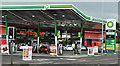
BP/Eurospar, Balmoral, Belfast (June 2016)
A recently-opened BP/Eurospar at 2-4 Upper Lisburn Road. Built on the site of a former Topaz station (background in Image). I have no connection with the business.
Image: © Albert Bridge
Taken: 25 Jun 2016
0.25 miles