IMAGES TAKEN NEAR TO
Musgrave Park Court, BELFAST, BT9 7HZ

Introduction

This page details the photographs taken nearby to Musgrave Park Court, BT9 7HZ by members of the Geograph project.

The Geograph project started in 2005 with the aim of publishing, organising and preserving representative images for every square kilometre of Great Britain, Ireland and the Isle of Man.

There are currently over 7.5m images from over14,400 individuals and you can help contribute to the project by visiting https://www.geograph.org.uk

Image Map


Images are licensed for reuse under creativecommons.org/licenses/by-sa/2.0
Notes
  • Clicking on the map will re-center to the selected point.
  • The higher the marker number, the further away the image location is from the centre of the postcode.

Image Listing (86 Images Found)

Images are licensed for reuse under creativecommons.org/licenses/by-sa/2.0
  • ...
Image
Details
Distance
1
Grovelands Park, Belfast
Grovelands park and ornamental gardens is located off Stockman's Lane in south Belfast. Until recently it was used as a base for horticultural apprentices working in the parks and cemeteries section of Belfast City Council. This has now been discontinued but the park remains open for visitors and contains a range of trees, shrubs, conifers, heathers, bedding displays and lawns.
Image: © Rossographer Taken: 3 Jun 2008
0.04 miles
2
The "Enterprise" at Balmoral, Belfast
See Image The 07.35 Dublin – Belfast passing Balmoral station, at reduced speed following a signal check.
Image: © Albert Bridge Taken: 3 Nov 2007
0.05 miles
3
Balmoral station, Belfast (2007-1)
The line between Belfast and Lisburn opened in 1839. Balmoral station opened circa 1858. It was re-built in the 60’s when Stockman’s Lane Image was widened to become part of the Belfast outer ring road. The view is towards Lisburn/Dublin. For a later view see Image (December 2012).
Image: © Albert Bridge Taken: 3 Nov 2007
0.06 miles
4
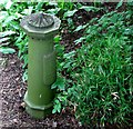
Old Boundary Post, Grovelands Park, Belfast
An old boundary post, marking the limits of the St Annes Ward in Belfast, hidden in the shrubbery at Grovelands Image Other examples from around Belfast can be seen at http://www.geograph.org.uk/search.php?i=2805798
Image: © Rossographer Taken: 3 Jun 2008
0.06 miles
5
Musgrave Park
Cutting the grass on the bowling green.
Image: © Paul McIlroy Taken: 18 May 2007
0.06 miles
6
Bowling club
Bowls club situated in Musgrave Park. Divis Mountain and the mast of the BBC transmitter are in the background. http://www.belfastcity.gov.uk/parksandopenspaces/parksdetails.asp?id=95
Image: © Paul McIlroy Taken: 18 May 2007
0.06 miles
7
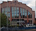
The King's Hall
Venue for pop concerts, boxing matches, exhibitions and conferences, today it's an agricultural show.
Image: © Paul McIlroy Taken: 18 May 2007
0.07 miles
8
The King's Hall
Image: © Paul McIlroy Taken: 18 May 2007
0.07 miles
9
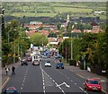
Stockmans Lane
No longer a lane as it is a link in the Belfast ring road system, the view is towards Andersonstown, the church in the top right is St Teresa's Glen Road Image
Image: © Paul McIlroy Taken: 18 May 2007
0.07 miles
10
Balmoral railway station
Dominated by The King's Hall in the background.
Image: © Thomas Nugent Taken: 1 Jun 2019
0.07 miles
  • ...