IMAGES TAKEN NEAR TO
Ethel Street, BELFAST, BT9 7FW

Introduction

This page details the photographs taken nearby to Ethel Street, BT9 7FW by members of the Geograph project.

The Geograph project started in 2005 with the aim of publishing, organising and preserving representative images for every square kilometre of Great Britain, Ireland and the Isle of Man.

There are currently over 7.5m images from over14,400 individuals and you can help contribute to the project by visiting https://www.geograph.org.uk

Image Map


Images are licensed for reuse under creativecommons.org/licenses/by-sa/2.0
Notes
  • Clicking on the map will re-center to the selected point.
  • The higher the marker number, the further away the image location is from the centre of the postcode.

Image Listing (307 Images Found)

Images are licensed for reuse under creativecommons.org/licenses/by-sa/2.0
  • ...
Image
Details
Distance
1
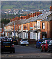
Ethel Street, Belfast
A street of terrace houses running from the Lisburn Road to Great Northern Street (background).
Image: © Albert Bridge Taken: 9 Jul 2009
0.03 miles
2
Great Northern Street sign, Belfast
Cast name sign, with painted postal-district number, at the Lisburn Avenue end of Great Northern Street Image
Image: © Albert Bridge Taken: 20 May 2011
0.04 miles
3
Ethel Street sign, Belfast
Modern sign on a low wall at the Great Northern Street end of Ethel Street in Belfast.
Image: © Rossographer Taken: 6 Jan 2012
0.04 miles
4
Surrey Street, Belfast
Terrace on the northern side of Surrey Street http://www.geograph.org.uk/search.php?i=27968724 in Belfast. In the far distance can be seen houses and buildings in west Belfast which climb up towards the lower slopes of Black Mountain.
Image: © Rossographer Taken: 12 Jan 2012
0.05 miles
5
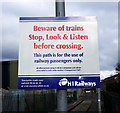
Warning sign, Adelaide halt
Warning sign at Adelaide in Belfast. A path connects Adelaide with Falcon Road / Apollo Road. It crosses an almost entirely disused ex-goods line but this recently erected sign warns users about possible dangers - see Image for a good overview of the path and line. The path may be for passengers only but in practice it is also a good short cut from the Lisburn Road to Boucher Road and retail park.
Image: © Rossographer Taken: 22 Feb 2010
0.05 miles
6
Adelaide Avenue, Belfast
Adelaide Avenue runs from the Lisburn Road to Great Northern Street (foreground). It was built over a number of years at the end of the 19th and start of the 20th centuries. Greatly enhanced by the trees, it remains, as the estate agents say, ever popular.
Image: © Albert Bridge Taken: 9 Jul 2009
0.06 miles
7
Railway at Adelaide, Belfast
With the closure of the goods yard Image and the adjacent Guinness depot the connection was severed. The line now ends at a buffer stop. A scene such as Image has now passed into history. The rails are rusty through disuse. See also Image
Image: © Albert Bridge Taken: 9 Jul 2009
0.06 miles
8
Warning sign, Adelaide halt
Another warning sign at the end of the platform at Adelaide halt in Belfast - see also Image for another. See also Image - this sign is visible in the bottom right.
Image: © Rossographer Taken: 22 Feb 2010
0.06 miles
9
New train maintenance depot, Belfast (28)
The view of the new sidings on the Lisburn side of the footbridge carrying the path, from Adelaide station (middle top), to the Apollo Road. The Google map and the satellite photograph do not coincide.
Image: © Albert Bridge Taken: 26 Dec 2011
0.06 miles
10
Windsor Road, Belfast
Another street of terraced housing running from the Lisburn Road to Great Northern Street.
Image: © Rossographer Taken: 4 Mar 2008
0.06 miles
  • ...