
IMAGES TAKEN NEAR TO
Windsor Drive, BELFAST, BT9 7FH
Introduction
This page details the photographs taken nearby to Windsor Drive, BT9 7FH by members of the Geograph project.
The Geograph project started in 2005 with the aim of publishing, organising and preserving representative images for every square kilometre of Great Britain, Ireland and the Isle of Man.

There are currently over 7.5m images from over14,400 individuals and you can help contribute to the project by visiting https://www.geograph.org.uk
Image Map
Images are licensed for reuse under creativecommons.org/licenses/by-sa/2.0
Notes
- Clicking on the map will re-center to the selected point.
- The higher the marker number, the further away the image location is from the centre of the postcode.
Image Listing (330 Images Found)
Images are licensed for reuse under creativecommons.org/licenses/by-sa/2.0
Image
Details
Distance
1
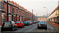
Meadowbank Place, Belfast
Meadowbank Place runs from Meadowbank Street Image to Great Northern Street (background). It seems to have been built in the years just before WW1.
Image: © Albert Bridge
Taken: 22 Jan 2011
0.03 miles
2
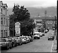
Lower Windsor Avenue, Belfast
Street running off the Lisburn Road. The floodlights and part of a stand of Windsor Park, home of Linfield Football Club and (currently) where Northern Ireland play their home games, can be seen in the background.
Image: © Rossographer
Taken: 6 Aug 2008
0.04 miles
4
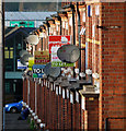
Terrace, Chadwick Street, Belfast
Detail of a terrace on the northern side of Chadwick Street http://www.geograph.org.uk/search.php?i=27969214 which runs between the Lisburn Road and Great Northern Street - this is the view towards the latter. 'To Let' signs and satellite dishes in abundance.
Image: © Rossographer
Taken: 12 Jan 2012
0.06 miles
5
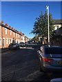
Chadwick Street, Belfast
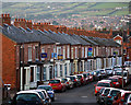
Terrace on the southern side of Chadwick Street http://www.geograph.org.uk/search.php?i=27969214 which runs between the Lisburn Road and Great Northern Street - this is the view towards the latter. In the far distance can be seen houses and buildings in west Belfast which climb up towards the lower slopes of Black Mountain.
Image: © Rossographer
Taken: 12 Jan 2012
0.06 miles
6
Terrace, Chadwick Street, Belfast
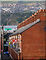
Detail of a terrace on the northern side of Chadwick Street http://www.geograph.org.uk/search.php?i=27969214 which runs between the Lisburn Road and Great Northern Street - this is the view towards the latter. 'To Let' signs and satellite dishes in abundance. In the far distance can be seen houses and buildings in west Belfast which climb up towards the lower slopes of Black Mountain.
Image: © Rossographer
Taken: 12 Jan 2012
0.06 miles
7
Lower Windsor Avenue, Belfast
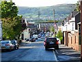
See also: Image Windsor Park - home of Linfield F.C. and the Northern Irish national soccer team - sits beyond the houses at the bottom.
Image: © Dean Molyneaux
Taken: 23 Sep 2009
0.06 miles
8
Meadowbank Place sign, Belfast
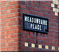
Tiled sign with painted postal district number, at the Meadowbank Street Image end of Meadowbank Place Image
Image: © Albert Bridge
Taken: 22 Jan 2011
0.06 miles
9
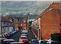
Chadwick Street, Belfast
Chadwick Street http://www.geograph.org.uk/search.php?i=27969214 runs between the Lisburn Road and Great Northern Street - this is the view towards the latter. In the far distance can be seen houses and buildings in west Belfast which climb up towards the lower slopes of Black Mountain.
Image: © Rossographer
Taken: 12 Jan 2012
0.06 miles
10
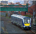
Train, Belfast
Northern Ireland Railways C4K set 4015 heading to Belfast Great Victoria Street shortly after leaving Adelaide station. It is working the 1215 Portadown to Bangor service (due in Bangor at 1343).
Image: © Rossographer
Taken: 27 Mar 2013
0.06 miles