
IMAGES TAKEN NEAR TO
Tates Avenue, BELFAST, BT9 7BZ
Introduction
This page details the photographs taken nearby to Tates Avenue, BT9 7BZ by members of the Geograph project.
The Geograph project started in 2005 with the aim of publishing, organising and preserving representative images for every square kilometre of Great Britain, Ireland and the Isle of Man.

There are currently over 7.5m images from over14,400 individuals and you can help contribute to the project by visiting https://www.geograph.org.uk
Image Map
Images are licensed for reuse under creativecommons.org/licenses/by-sa/2.0
Notes
- Clicking on the map will re-center to the selected point.
- The higher the marker number, the further away the image location is from the centre of the postcode.
Image Listing (288 Images Found)
Images are licensed for reuse under creativecommons.org/licenses/by-sa/2.0
Image
Details
Distance
1
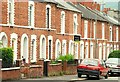
Donnybrook Street, Belfast (2)
See Image The southern side of the street includes what might be considered an example of a traditional/typical Belfast terrace. Note that the houses have porches.
Image: © Albert Bridge
Taken: 28 Jun 2009
0.01 miles
2
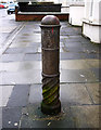
Old post, Belfast
An old post on Tate's Avenue in Belfast (also seen in Image). It is close and very similar to the Water Boundary post seen in Image but has no inscription at the top.
Image: © Rossographer
Taken: 21 Feb 2011
0.03 miles
3
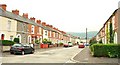
Donnybrook Street, Belfast (1)
Donnybrook Street runs from the Lisburn Road to Northbrook Street. It was built, over a number of years, towards the end of the 19th century but still had work in progress in 1901. Lorne Street is at bottom right and Northbrook Street Image in the background. See also Image
Image: © Albert Bridge
Taken: 28 Jun 2009
0.04 miles
4
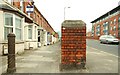
Tate's Avenue, Belfast (2)
Image shows that Tate’s Avenue is built on two levels. This is where the houses and the road separate. The road rises to cross the railway and then drops towards Glenmachan Street. There has been much (controversial) redevelopment in the area (known as “The Village”) with professionals, students and migrant workers replacing some of the long-term residents. See also Image Continue to Image
Image: © Albert Bridge
Taken: 28 Jun 2009
0.04 miles
5
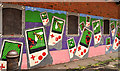
"Insect" mural, Belfast
An “insect” mural on the southern side of Tate’s Avenue bridge. Part of it can be seen (background) in Image
Image: © Albert Bridge
Taken: 11 Sep 2011
0.04 miles
6
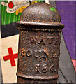
Water boundary post, Belfast (inscription)
The inscription on this water boundary post Image beside the Tate’s Avenue bridge. The “insect” mural Image is in the background.
Image: © Albert Bridge
Taken: 11 Sep 2011
0.04 miles
7

Old post, Belfast
An old post on Tate's Avenue in Belfast (south side, under the bridge). It is adjacent and very similar to the Water Boundary post seen in Image but has no inscription at the top.
Image: © Rossographer
Taken: 21 Feb 2011
0.04 miles
8

Water Boundary post, Belfast
An old post located on Tate's Avenue in Belfast (south side, under the bridge). The inscription at the top of the post reads "Water Boundary 1841". It is most probably a post indicating the limits of the newly-formed Belfast Water Commissioners (founded 1840). It is also likely that the post has been resited here from its original location - it appears to have been placed here to block vehicular access to this part of the street and is close to two similar posts - although neither of those carry inscriptions - Image & Image
Image: © Rossographer
Taken: 21 Feb 2011
0.04 miles
9
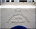
Foundry inscription, Belfast
Millfield Foundry inscription on the Tate's Avenue bridge in Belfast. The bridge was constructed in 1926.
Image: © Rossographer
Taken: 21 Feb 2011
0.04 miles
10
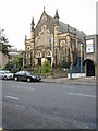
Ulsterville Presbyterian Church
The Congregation was established in 1902. This building dates from 1924.
Image: © Brian Shaw
Taken: 1 Oct 2005
0.05 miles