
IMAGES TAKEN NEAR TO
Bristow Park, BELFAST, BT9 6TG
Introduction
This page details the photographs taken nearby to Bristow Park, BT9 6TG by members of the Geograph project.
The Geograph project started in 2005 with the aim of publishing, organising and preserving representative images for every square kilometre of Great Britain, Ireland and the Isle of Man.

There are currently over 7.5m images from over14,400 individuals and you can help contribute to the project by visiting https://www.geograph.org.uk
Image Map
Images are licensed for reuse under creativecommons.org/licenses/by-sa/2.0
Notes
- Clicking on the map will re-center to the selected point.
- The higher the marker number, the further away the image location is from the centre of the postcode.
Image Listing (5 Images Found)
Images are licensed for reuse under creativecommons.org/licenses/by-sa/2.0
Image
Details
Distance
1
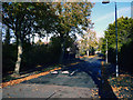
Malone Hill Park, Belfast
The lower end of Malone Hill Park in Belfast. This, and most surrounding streets, were covered in fallen leaves.
Image: © Rossographer
Taken: 1 Nov 2011
0.19 miles
2
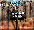
Street sign, Belfast
Old tiled street sign on what is probably the original iron post at Strangford Avenue in Belfast.
Image: © Rossographer
Taken: 1 Nov 2011
0.21 miles
3
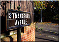
Street sign, Belfast
Old tiled street sign on what is probably the original iron post at Strangford Avenue in Belfast. Shrewsbury Park is seen behind.
Image: © Rossographer
Taken: 1 Nov 2011
0.21 miles
4
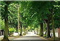
Cambourne Park, Belfast
Running off the Malone Road, Cambourne Park has a tree-lined street and the high hedges not untypical of the upper reaches of BT9.
Image: © Albert Bridge
Taken: 1 Aug 2009
0.21 miles
5
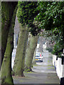
Cambourne Park, Belfast
Another pleasant tree lined avenue in south Belfast.
Image: © Rossographer
Taken: 20 Feb 2008
0.24 miles