
IMAGES TAKEN NEAR TO
Malone Road, BELFAST, BT9 6TB
Introduction
This page details the photographs taken nearby to Malone Road, BT9 6TB by members of the Geograph project.
The Geograph project started in 2005 with the aim of publishing, organising and preserving representative images for every square kilometre of Great Britain, Ireland and the Isle of Man.

There are currently over 7.5m images from over14,400 individuals and you can help contribute to the project by visiting https://www.geograph.org.uk
Image Map
Images are licensed for reuse under creativecommons.org/licenses/by-sa/2.0
Notes
- Clicking on the map will re-center to the selected point.
- The higher the marker number, the further away the image location is from the centre of the postcode.
Image Listing (47 Images Found)
Images are licensed for reuse under creativecommons.org/licenses/by-sa/2.0
Image
Details
Distance
1
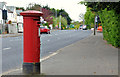
Pillar box, Belfast
GR pillar box on the Malone Road, outward of Mount Eden Park.
Image: © Albert Bridge
Taken: 23 Apr 2011
0.02 miles
2
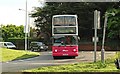
Suburban bus, Belfast
A Transbus-bodied Volvo double-decker negotiates the Malone/House of Sport Image roundabout on service 8B (Donegall Square East – Erinvale – 19 mins off-peak and up to 33 mins during the evening peak).
Image: © Albert Bridge
Taken: 1 May 2009
0.04 miles
3
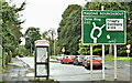
Telephone box, Malone Road, Belfast (September 2017)
A KX plus telephone box at the Malone (House of Sport) roundabout.
Image: © Albert Bridge
Taken: 10 Sep 2017
0.04 miles
4
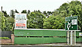
Nos 236 & 238 Malone Road, Belfast (June 2019)
The two detached houses have been demolished. The site is now advertised for sale and suitable for apartments.
The agents’ description includes “The subject property is located beside the House of Sport roundabout, approximately 3 miles south of Belfast City Centre and benefits from a substantial frontage of c. 100 ft to the Malone Road. The site presents a rare opportunity for a developer to acquire land with full planning permission in this highly sought after residential area”.
I have no connection with the site and cannot enter into correspondence.
Image: © Albert Bridge
Taken: 24 Jun 2019
0.05 miles
5
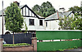
Nos 236/238 Malone Road, Belfast (September 2017)
Two vacant houses, now hidden by vegetation and hoardings, close to the Malone roundabout. There is (16 December 2015) the following planning permission: “Z/2014/0697/F Demolition of 2 No. semi-detached houses and construction of 9 No. apartments in 1 Block (amended plans and form) 236-238 Malone Road Belfast BT9 5LR”. The site has an unusual shape and is best understood by reference to the map on the NI Planning Portal.
The houses seem to have replaced the Malone Cottages sometime after the early 1920’s.
Image: © Albert Bridge
Taken: 10 Sep 2017
0.05 miles
6
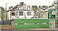
No 236 Malone Road, Belfast (April 2018)
I haven’t been here during the working week but it now appears that no 236 is at an early stage of demolition.
Image: © Albert Bridge
Taken: 14 Apr 2018
0.05 miles
7
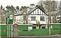
No 238 Malone Road, Belfast (April 2018)
No 238 - roof and glazing intact.
Image: © Albert Bridge
Taken: 14 Apr 2018
0.06 miles
8
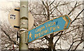
Faded towpath sign, Belfast
A faded and slightly bent blue sign, close to the Malone roundabout, pointing the way to the Lagan Valley Park (it includes the towpath) at Shaw’s Bridge. A survivor – the brown sign Image is now standard. See also Image
Image: © Albert Bridge
Taken: 24 Dec 2009
0.08 miles
9
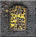
Fire hydrant cover, Belfast
Fire hydrant cover located on the Malone Road, Belfast. It is marked 'Belfast Water Works' which ceased to exist in 1973. I don't know what the numbers relate to on the various covers from the water works - they seem to range from 1 to 6.
Image: © Rossographer
Taken: 1 Nov 2011
0.08 miles
10
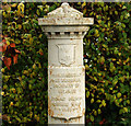
Boundary post, Belfast
There are several in the area including Image and Image This one, dated 1918, marks the parliamentary and municipal boundaries – both have since changed. The latter is due for another in the not too distant future.
Image: © Albert Bridge
Taken: 24 Dec 2009
0.08 miles