
IMAGES TAKEN NEAR TO
Oakwood Mews, BELFAST, BT9 6SF
Introduction
This page details the photographs taken nearby to Oakwood Mews, BT9 6SF by members of the Geograph project.
The Geograph project started in 2005 with the aim of publishing, organising and preserving representative images for every square kilometre of Great Britain, Ireland and the Isle of Man.

There are currently over 7.5m images from over14,400 individuals and you can help contribute to the project by visiting https://www.geograph.org.uk
Image Map
Images are licensed for reuse under creativecommons.org/licenses/by-sa/2.0
Notes
- Clicking on the map will re-center to the selected point.
- The higher the marker number, the further away the image location is from the centre of the postcode.
Image Listing (29 Images Found)
Images are licensed for reuse under creativecommons.org/licenses/by-sa/2.0
Image
Details
Distance
1
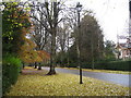
Malone Park
Malone Park is the largest private avenue in the United Kingdom. The majority of the 72 houses are Victorian, set in large grounds and were originally the homes of the Protestant owners of large linen mills in Belfast. The road is lined with lime trees which shed their leaves early.
Image: © Sue Adair
Taken: 7 Nov 2008
0.09 miles
2
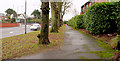
Trees and footpath, Belfast
A line of trees separating the footpath from the busy road at the Malone Road end of Balmoral Avenue Image
Image: © Albert Bridge
Taken: 13 Jan 2011
0.10 miles
3
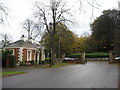
Gate Lodge, Malone Park
There are two gate lodges at Malone Park, one at Malone Road and one at Lisburn Road. This is the main lodge at Malone Road.
Image: © Sue Adair
Taken: 7 Nov 2008
0.11 miles
4
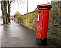
Pillar box, Belfast
A leaning EIIR pillar box, on the Malone Road, close to Balmoral Avenue (background).
Image: © Albert Bridge
Taken: 13 Jan 2011
0.14 miles
5
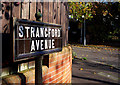
Street sign, Belfast
Old tiled street sign on what is probably the original iron post at Strangford Avenue in Belfast. Shrewsbury Park is seen behind.
Image: © Rossographer
Taken: 1 Nov 2011
0.14 miles
6
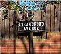
Street sign, Belfast
Old tiled street sign on what is probably the original iron post at Strangford Avenue in Belfast.
Image: © Rossographer
Taken: 1 Nov 2011
0.14 miles
7
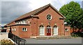
Church hall, Belfast
After the breathless excitement of the church Image, the adjacent hall brings us back to earth with its simple neo-Georgian, quasi-municipal lines.
Image: © Albert Bridge
Taken: 1 Aug 2009
0.15 miles
8
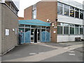
Public records office Northern Ireland
Situated in Balmoral Ave, it is usually referred to as Proni
Image: © Paul McIlroy
Taken: 9 Apr 2009
0.15 miles
9
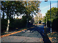
Malone Hill Park, Belfast
The lower end of Malone Hill Park in Belfast. This, and most surrounding streets, were covered in fallen leaves.
Image: © Rossographer
Taken: 1 Nov 2011
0.16 miles
10
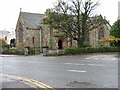
Parish Church of St. John the Evangelist
This Church of Ireland Church was built in 1892: the transepts were added in 1906.
Image: © Brian Shaw
Taken: 8 Nov 2005
0.16 miles