1
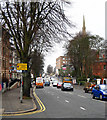
122 Eglantine Avenue, Belfast
Vacant property at the Malone Road end of Eglantine Avenue. Planning permission given in 2009 for “Demolition of existing building and erection of 6 apartments”. Continue to
Image
Image: © Albert Bridge
Taken: 5 Apr 2010
0.02 miles
2
No 122 Eglantine Avenue, Belfast (2)
See
Image Thirteen months later with the replacement under construction.
Image: © Albert Bridge
Taken: 22 May 2011
0.02 miles
3
The Botanic Inn, Belfast
Pictured along University Road
Image: © Kenneth Allen
Taken: 7 Nov 2017
0.02 miles
4
The Wellington Park Hotel, Belfast
The long-established Wellington Park Hotel at the corner of the Malone Road (foreground) and Wellington Park. There is now an application for planning permission: “0476/F Wellington Park Hotel , 21 Malone Road , 6 & 14 Wellington Park , Belfast Partial demolition, refurbishment and extensions to existing hotel; providing additional 94 bedrooms, apart-hotel accommodation, 2 function rooms, syndicate rooms, cafe and restaurant space, office extension to 14 Wellington Park, 2 levels of basement car parking, alterations to existing surface car parking and circulation and landscaping.”
Image: © Albert Bridge
Taken: 22 May 2011
0.03 miles
5
Nos 108-110 Eglantine Avenue, Belfast
Nos 108 (left) and 110 Eglantine Avenue, currently boarded up, for which there is planning permission for “Amendment to existing approval reference Z/2006/2232 for the demolition to existing dwellings and erection of 15no apartments which consists of the reduction of the footprint to apartments 3, 7, 11 and 14 and alterations to rear and side elevations”.
Image: © Albert Bridge
Taken: 10 Aug 2010
0.03 miles
6
Waiting restriction signs, Malone Road, Belfast (March 2016)
Urban clearway and taxi rank signs, on the Malone Road, close to the “Bot”
Image
Image: © Albert Bridge
Taken: 20 Mar 2016
0.03 miles
7
Entrance to 'The Bankers Club', Belfast
Located at 31 Malone Road - see http://www.bankers-club.co.uk/ for more information. Given the current economic climate a place to drown your sorrows perhaps?
Image: © Rossographer
Taken: 24 Oct 2008
0.03 miles
8
Park Lane, Belfast
A narrow street, off Wellington Park. The latter was started in the late 1870’s but Park Lane seems to have come along about 20 years later when it was home to a horse dealer/trainer and a posting establishment.
Image: © Albert Bridge
Taken: 23 May 2010
0.03 miles
9
Malone Road, Belfast
Looking down the road towards Belfast City Centre. It is a constantly busy stretch of road during weekdays.
Image: © Rossographer
Taken: 5 Mar 2008
0.03 miles
10
Telephone boxes, Malone Road, Belfast (December 2014)
Two “KX Plus” telephone boxes outside the David Keir Building. In some cases, where there are two, one is being removed - see
Image and
Image
Image: © Albert Bridge
Taken: 21 Dec 2014
0.04 miles


