
IMAGES TAKEN NEAR TO
Balmoral Avenue, BELFAST, BT9 6NW
Introduction
This page details the photographs taken nearby to Balmoral Avenue, BT9 6NW by members of the Geograph project.
The Geograph project started in 2005 with the aim of publishing, organising and preserving representative images for every square kilometre of Great Britain, Ireland and the Isle of Man.

There are currently over 7.5m images from over14,400 individuals and you can help contribute to the project by visiting https://www.geograph.org.uk
Image Map
Images are licensed for reuse under creativecommons.org/licenses/by-sa/2.0
Notes
- Clicking on the map will re-center to the selected point.
- The higher the marker number, the further away the image location is from the centre of the postcode.
Image Listing (85 Images Found)
Images are licensed for reuse under creativecommons.org/licenses/by-sa/2.0
Image
Details
Distance
1
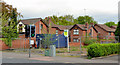
Development site, Balmoral Avenue, Belfast (May 2014)
A vacant site (numbered, I think no 6 Balmoral Avenue), once the site of a newsagent, now with an estate agent’s sign advertising a proposed “new build”. This photograph appears as a matter of geographical and historical record only. I have no connection with anyone involved in the development.
Image: © Albert Bridge
Taken: 4 May 2014
0.02 miles
2
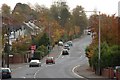
Balmoral Avenue, Belfast
Balmoral Avenue runs from the Malone Road to the Lisburn Road. It now forms part of the outer ring road. The view is towards the Malone Road.
Image: © Albert Bridge
Taken: 3 Nov 2007
0.02 miles
3
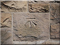
Bench Mark, Belfast
Cut bench mark on the southern side of Malone Presbyterian Church Image on the Lisburn Road, Belfast.
The mark is 13.52 metres above MSL.
See also http://www.geograph.org.uk/search.php?i=11037856 for many other examples I have found.
Image: © Rossographer
Taken: 12 Mar 2010
0.04 miles
4
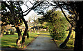
The Friends Burial Ground, Balmoral, Belfast
The Friends Burial Ground at Balmoral Avenue opened in 1837 and is still in use. More detailed information here http://www.southbelfastquakers.org/sbq/Library_files/Friends%20Buriel%20Ground_Layout%201.pdf. The photograph was taken through the locked gate.
Image: © Albert Bridge
Taken: 19 Jan 2014
0.06 miles
5
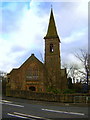
Malone Presbyterian Church, Belfast
Not actually on the Malone Road but at the upper end of the Lisburn Road at the junction with Balmoral Avenue.
Image: © Rossographer
Taken: 24 Jan 2008
0.07 miles
6
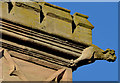
Gargoyle, Balmoral, Belfast
A weathered gargoyle (one of four) on the tower of Malone Presbyterian church, at the corner of the Lisburn Road and Balmoral Avenue. The church was completed in 1899 to a design by Young and Mackenzie who also designed Fitzroy Image
Image: © Albert Bridge
Taken: 10 Dec 2012
0.08 miles
7
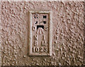
Flush Bracket, Belfast
Flush bracket on the northern tip of the King's Hall, Belfast Image
The number on the bracket is OSNIBM 1023.
The mark is 16.16 metres above MSL.
A flush bracket is a type of bench mark set onto the face of a building. See also http://www.geograph.org.uk/search.php?i=11037856 for many other examples I have found.
Image: © Rossographer
Taken: 19 May 2010
0.11 miles
8
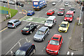
Crossroads, Balmoral, Belfast
The busy crossroads where the Lisburn Road (left to right) crosses Balmoral Avenue Image (top) and Stockman’s Lane Image (bottom). This flyover Image (from where the photograph was taken) eased the problem for the through traffic on the Lisburn Road but it remains the source of delays at peak times. Balmoral Avenue is one of the two weak spots in the Belfast outer ring road Image This is the other Image
Image: © Albert Bridge
Taken: 22 Jun 2011
0.11 miles
9
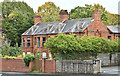
Nos 448-450 Lisburn Road, Belfast - September 2017(1)
A pair of large semis, with substantial grounds, next to Malone Presbyterian church hall (right). Boarded-up, fenced-off and (apparently) without any application for planning permission to re-develop.
I have no connection with the properties and cannot enter into correspondence. See also Image
Image: © Albert Bridge
Taken: 24 Sep 2017
0.12 miles
10
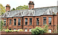
Nos 448-450 Lisburn Road, Belfast - September 2017(2)
See Image A front view.
Image: © Albert Bridge
Taken: 24 Sep 2017
0.12 miles