
IMAGES TAKEN NEAR TO
Adelaide Park, BELFAST, BT9 6FY
Introduction
This page details the photographs taken nearby to Adelaide Park, BT9 6FY by members of the Geograph project.
The Geograph project started in 2005 with the aim of publishing, organising and preserving representative images for every square kilometre of Great Britain, Ireland and the Isle of Man.

There are currently over 7.5m images from over14,400 individuals and you can help contribute to the project by visiting https://www.geograph.org.uk
Image Map
Images are licensed for reuse under creativecommons.org/licenses/by-sa/2.0
Notes
- Clicking on the map will re-center to the selected point.
- The higher the marker number, the further away the image location is from the centre of the postcode.
Image Listing (150 Images Found)
Images are licensed for reuse under creativecommons.org/licenses/by-sa/2.0
Image
Details
Distance
1
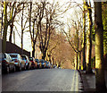
Cadogan Park, Belfast
Cadogan Park runs from the Malone Road to the Lisburn Road in Belfast. This is the view of the road from near the junction with the Malone Road.
Image: © Rossographer
Taken: 26 Jan 2009
0.05 miles
2
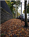
Autumnal leaves, Cadogan Park
Fallen leaves covering the pavement on Cadogan Park off the Malone Road in Belfast. During autumn Belfast City Council send personnel and equipment to the area almost on a daily basis in a bid to keep roads and paths clear.
Image: © Rossographer
Taken: 26 Oct 2009
0.07 miles
3
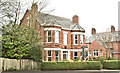
Former Malone Guest House, Belfast (April 2018)
See Image The former Malone Guest House, 79 Malone Road, now with an “agreed” sign. A site with development potential - subject to planning (layman’s opinion!).
Image: © Albert Bridge
Taken: 14 Apr 2018
0.09 miles
4

Nos 36-38 Windsor Park, Belfast (2013-4)
The south western end of the new development, well hidden by the summer trees.
Image: © Albert Bridge
Taken: 11 Aug 2013
0.10 miles
5
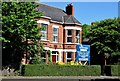
No 79 Malone Road, Belfast (June 2015)
A former guest house now offered for sale. The agent’s description includes: “Malone Guest House is a fine example of late 19th century architecture which gives the Malone Road and surrounding leafy avenues their distinct character. It has been lavishly maintained and extended in its current ownership and retains many original features.” This photograph appears as a matter of record only. I have no connection with any of the parties involved in the sale. Continue to Image
Image: © Albert Bridge
Taken: 13 Jun 2015
0.10 miles
6
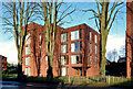
Nos 36-38 Windsor Park, Belfast - 2014 (2)
A completed block at the Lisburn Road end of the site.
Image: © Albert Bridge
Taken: 19 Jan 2014
0.10 miles
7
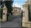
MacNeice House, 77 Malone Road, Belfast
MacNeice House, 77 Malone Road, Belfast, is one of the finest old properties in the area. It is now converted to offices for use by, among others, the Arts Council Northern Ireland. A more modern extension joins the house with the address 75 Malone Road and houses more offices. The description below is taken from http://www.artscouncil-ni.org/departs/all/report/MacNeice%20House%20doc.pdf
MacNeice House - the current home of the Arts Council of Northern Ireland at 77 Malone Road - is an imposing double-fronted Victorian merchant’s villa dating from 1889. Designed by the Belfast architect Samuel Stevenson for James Johnston, a successful tea merchant who owned much of the surrounding area, in many ways it is typical of the substantial late-nineteenth century houses which were built for the wealthy industrialists and entrepreneurs of Belfast who, from the 1850s, began to favour the airy Malone ridge over the crowded centre of the burgeoning industrial town.
Image: © Rossographer
Taken: 4 Mar 2008
0.10 miles
8

Nos 36-38 Windsor Park, Belfast - 2014 (1)
The completed development seen from the Malone Road side.
Image: © Albert Bridge
Taken: 19 Jan 2014
0.10 miles
9

Nos 36-38 Windsor Park, Belfast (2012-3)
The view between the two blocks.
Image: © Albert Bridge
Taken: 15 Dec 2012
0.10 miles
10

Nos 36-38 Windsor Park, Belfast (2013-3)
The south western end of the site.
Image: © Albert Bridge
Taken: 7 Apr 2013
0.10 miles