
IMAGES TAKEN NEAR TO
Lisburn Road, BELFAST, BT9 6AH
Introduction
This page details the photographs taken nearby to Lisburn Road, BT9 6AH by members of the Geograph project.
The Geograph project started in 2005 with the aim of publishing, organising and preserving representative images for every square kilometre of Great Britain, Ireland and the Isle of Man.

There are currently over 7.5m images from over14,400 individuals and you can help contribute to the project by visiting https://www.geograph.org.uk
Image Map
Images are licensed for reuse under creativecommons.org/licenses/by-sa/2.0
Notes
- Clicking on the map will re-center to the selected point.
- The higher the marker number, the further away the image location is from the centre of the postcode.
Image Listing (237 Images Found)
Images are licensed for reuse under creativecommons.org/licenses/by-sa/2.0
Image
Details
Distance
1
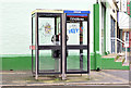
Telephone boxes, Wellesley Avenue, Belfast (February 2015)
Two KX100 telephone boxes at the Lisburn Road end of Wellesley Avenue http://www.geograph.org.uk/search.php?i=54014467.
Image: © Albert Bridge
Taken: 14 Feb 2015
0.01 miles
2
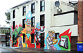
Bar mural, Belfast
A recently-painted mural, on a bar at the Lisburn Road end of Wellesley Avenue Image Image shows the gable, in August 2008, before the mural.
Image: © Albert Bridge
Taken: 16 Sep 2012
0.01 miles
3
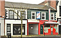
Nos 124-126 Lisburn Road, Belfast (April 2018)
Vacant properties with a “sold” sign. Previously described, by the agents as, “Located in a prominent position with 13.5m of frontage Large storage/warehouse unit to rear extending to c. 3,540 sq. ft. Site extending to 0.11 acres Planning permission was granted on 01/12/08 under Ref: Z/2007/1216F for the demolition of the existing buildings and construction of 2 no. hot food bars and 6 no. apartments The property is being sold with Vacant Possession”.
I have no connection with the property.
Image: © Albert Bridge
Taken: 15 Apr 2018
0.01 miles
4
![Ulsterville Presbyterian Church, Belfast [detail]](https://s1.geograph.org.uk/geophotos/01/21/74/1217453_fa1bb911_120x120.jpg)
Ulsterville Presbyterian Church, Belfast [detail]
Detail of the entrance gates to the church seen in Image Both gateposts leading to the church bear the name 'Ulsterville'.
Image: © Rossographer
Taken: 18 Mar 2009
0.02 miles
5

Mount Prospect Park, Belfast (2)
See Image Direct pedestrian access to Mount Prospect Park is by this set of steps at the side of Ulsterville Presbyterian Church Image (left). Vehicles have a longer route.
Image: © Albert Bridge
Taken: 7 Jul 2009
0.02 miles
6

Railings, Ulsterville Presbyterian Church, Belfast
Ornamental gatepost and railings on Ulsterville Presbyterian Church Image
Image: © Albert Bridge
Taken: 7 Jul 2009
0.02 miles
7
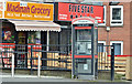
Telephone box, Lisburn Road, Belfast - March 2016(1)
A KX Plus telephone box near the corner of Belgravia Avenue (background - right).
Image: © Albert Bridge
Taken: 20 Mar 2016
0.02 miles
8
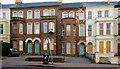
72-78 Wellington Park, Belfast (1)
At the Lisburn Road end of Wellington Park.
Image: © Albert Bridge
Taken: 13 Feb 2010
0.02 miles
9

No 89 Wellington Park, Belfast (October 2016)
The ground floor of a large former terrace house at the Lisburn Road end of Wellington Park - now with an “agreed” patch on the “for sale” board.
The agents’ website includes the following description “The property is an attractive three–storey terrace building suitable for a variety of uses, including offices, medical or dental consulting rooms or for conversion to residential use – either as a single private residence of apartments (subject to planning). The property incorporates excellent off–street parking on a brick pavior [sic] forecourt. The building is well maintained and has oil–fired central heating and all mains services.”
This photograph appears as a matter of record only. I have no connection with any of the parties involved in the sale.
Image: © Albert Bridge
Taken: 9 Oct 2016
0.02 miles
10
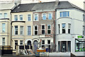
Nos 72-78 Wellington Park, Belfast (April 2017)
Work continuing on restoring no 78.
Image: © Albert Bridge
Taken: 15 Apr 2017
0.03 miles