
IMAGES TAKEN NEAR TO
Malone View Avenue, BELFAST, BT9 5PJ
Introduction
This page details the photographs taken nearby to Malone View Avenue, BT9 5PJ by members of the Geograph project.
The Geograph project started in 2005 with the aim of publishing, organising and preserving representative images for every square kilometre of Great Britain, Ireland and the Isle of Man.

There are currently over 7.5m images from over14,400 individuals and you can help contribute to the project by visiting https://www.geograph.org.uk
Image Map
Images are licensed for reuse under creativecommons.org/licenses/by-sa/2.0
Notes
- Clicking on the map will re-center to the selected point.
- The higher the marker number, the further away the image location is from the centre of the postcode.
Image Listing (10 Images Found)
Images are licensed for reuse under creativecommons.org/licenses/by-sa/2.0
Image
Details
Distance
1
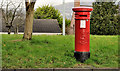
Pillar box, Belfast
EVIIR pillar box (BT9 255) at Malone View Park, Upper Malone Road.
Image: © Albert Bridge
Taken: 15 Feb 2012
0.08 miles
2
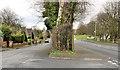
The Upper Malone Road, Belfast (2)
Original (left) and present lines of the Upper Malone Road near Finaghy Road South. Malone View Park is at middle right.
Image: © Albert Bridge
Taken: 15 Feb 2012
0.10 miles
3
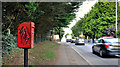
Letter box, Finaghy, Belfast
EIIR letter box on Finaghy Road South, near Greystown Park.
Image: © Albert Bridge
Taken: 6 Jul 2011
0.20 miles
4
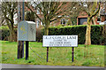
Drop box, Belfast
Drop box at the Upper Malone Road end of the Old Coach Lane.
Image: © Albert Bridge
Taken: 15 Feb 2012
0.20 miles
5

The Upper Malone Road, Belfast
See Image Part of the back road between Belfast and Lisburn/Dunmurry, this twisting stretch is still in suburban Belfast. The view is towards Lisburn from Linkview Park.
Image: © Albert Bridge
Taken: 1 Aug 2009
0.21 miles
6
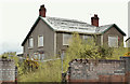
No 174 Finaghy Road South, Belfast (May 2016)
No 174 Finaghy Road South currently boarded up, fenced off and minus its roof tiles/slates.
Image: © Albert Bridge
Taken: 1 May 2016
0.22 miles
7
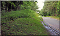
Road, Mary Peters Track, Belfast
The access road, looking out towards the Old Coach Road.
Image: © Albert Bridge
Taken: 6 Jul 2011
0.23 miles
8
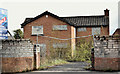
No 172 Finaghy Road South, Belfast (May 2016)
No 172 Finaghy Road South currently blocked up and fenced off. There is a “sold” path on the “for sale” sign.
Image: © Albert Bridge
Taken: 1 May 2016
0.23 miles
9
Stream, Mary Peters Track, Belfast
A stream, well below road level, on the south western side of the access road Image
Image: © Albert Bridge
Taken: 6 Jul 2011
0.24 miles
10
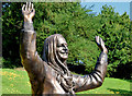
Mary Peters statue, Belfast
A statue, by John Sherlock, unveiled in 2013, of Dame Mary Peters CH DBE http://en.wikipedia.org/wiki/Mary_Peters_(athlete) at the north western end the track.
Image: © Albert Bridge
Taken: 25 Jul 2014
0.24 miles