
IMAGES TAKEN NEAR TO
Deramore Park, BELFAST, BT9 5JW
Introduction
This page details the photographs taken nearby to Deramore Park, BT9 5JW by members of the Geograph project.
The Geograph project started in 2005 with the aim of publishing, organising and preserving representative images for every square kilometre of Great Britain, Ireland and the Isle of Man.

There are currently over 7.5m images from over14,400 individuals and you can help contribute to the project by visiting https://www.geograph.org.uk
Image Map
Images are licensed for reuse under creativecommons.org/licenses/by-sa/2.0
Notes
- Clicking on the map will re-center to the selected point.
- The higher the marker number, the further away the image location is from the centre of the postcode.
Image Listing (19 Images Found)
Images are licensed for reuse under creativecommons.org/licenses/by-sa/2.0
Image
Details
Distance
1
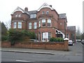
Malone Medical, Belfast
It is located on the Malone Road
Image: © Kenneth Allen
Taken: 19 Mar 2009
0.04 miles
2
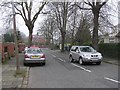
Myrtlefield Park, Belfast
Looking north-west from the Malone Road
Image: © Kenneth Allen
Taken: 19 Mar 2009
0.09 miles
3
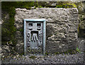
Flush Bracket, Belfast
Flush bracket located on the southern side of St John's Church of Ireland on the Malone Road in Belfast Image The number on the bracket is OSNIBM 3092.
A flush bracket is a type of bench mark set onto the face of a building. See also http://www.geograph.org.uk/search.php?i=11037856 for many other examples I have found.
Image: © Rossographer
Taken: 3 Mar 2010
0.09 miles
4
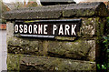
Osborne Park sign, Belfast
Tiled sign at the Malone Road end of Osborne Park – a residential street running between the Malone and Lisburn Roads. Attached to the boundary wall of this church Image
Image: © Albert Bridge
Taken: 13 Jan 2011
0.09 miles
5
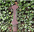
Cast-iron post, Osborne Park, Belfast - July 2016(1)
Part of an old cast-iron post, formerly used to hold a street name sign Image, at the Malone Road end of Osborne Park. It was made by the Millfield Foundry. Image shows the foundry name.
Image: © Albert Bridge
Taken: 23 Jul 2016
0.09 miles
6
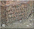
Cast-iron post, Osborne Park, Belfast - July 2016(2)
See Image The (just about legible) inscription “The Millfield Foundry Belfast” at the base of the post.
Image: © Albert Bridge
Taken: 23 Jul 2016
0.09 miles
7
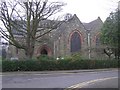
St. John's Church of Ireland, Belfast
It is located along the Malone Road
Image: © Kenneth Allen
Taken: 19 Mar 2009
0.10 miles
8
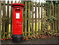
Pillar box, Belfast
GR pillar box, on the Malone Road near Osborne Park – previously seen in Image
Image: © Albert Bridge
Taken: 13 Jan 2011
0.10 miles
9
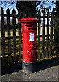
Postbox, Belfast
George V postbox on the Malone Road, close to the junction with Osborne Park.
Image: © Rossographer
Taken: 8 Mar 2010
0.10 miles
10
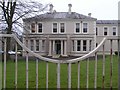
Construction Employers Federation offices, Belfast
It is located on the Malone Road
Image: © Kenneth Allen
Taken: 19 Mar 2009
0.12 miles